 SectionHiker.com Backpacking Gear Reviews and FAQs
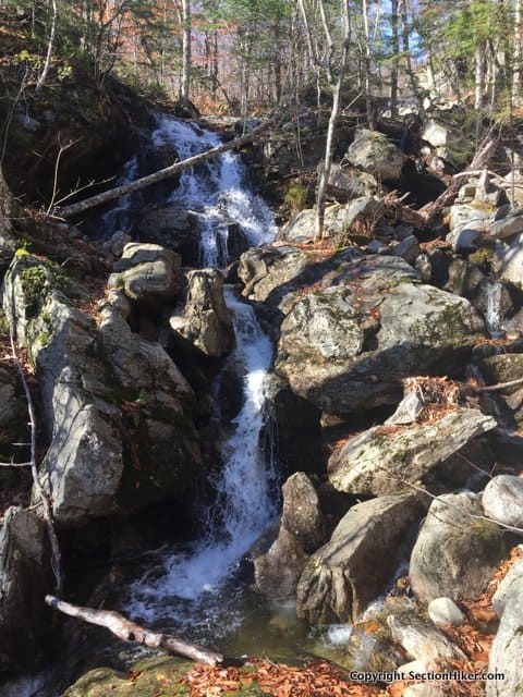
The Great Brook Trail runs up the south side of Red Rock Ridge, climbing besides Great Brook up to the col between Durgin Mountain and Butters Mountain in the Caribou-Speckled Wilderness. If you’ve never heard of any of these places, they are in the less-visited and less-developed Maine section of the White Mountain National Forest, but well worth the journey.
Finding the Great Brook Trail is a bit of an adventure in itself. The directions in the White Mountain Guide are excellent, but getting to the trail head requires traveling down an unpaved road bordered by small camps (cabins), well out of cell tower range. Just follow the guide’s directions and you should have no problems finding the trail head.
Once you arrive, it pays to carry the trail description with you on your hike, if only a cell phone photograph, so you can navigate the maze of logging roads that make up the first part of the trail. I’ve taken to tracking my hikes in these areas with Gaia, a smartphone navigation app, so I can find my way out on the return trip if I hit a confusing section of unmarked trail, something that provided useful on my hike out. Following trails in autumn is always extra challenging.
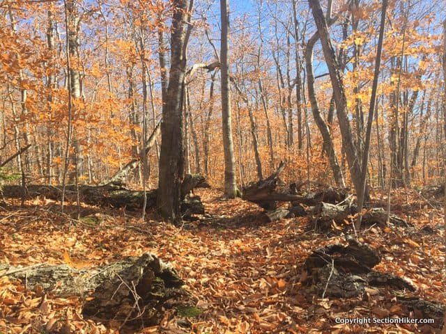
I hiked the Great Brook Trail in early November. It was sunny day but a cold wind blew through the trees which had dropped their leaves, which lay deep on the ground obscuring the rocks and roots below. More slippery than ice or packed snow, I proceeded cautiously, especially on the downhills trying to avoid an unexpected butt glissade in this remote corner of the mountains.
A heavy rain had brought the water level of the brook up nicely, which showed promise of being a good fly fishing venue. I made a mental note to head this way in the spring for a day of backcountry fishing.
The Great Brook Trail starts at a logging road gate, but you can drive down it about a mile if it’s open and you’d rather not walk on the road. There’s a small water fall and a number of campsites at the end of the road before the edge of the forest, a useful fact if you like the free primitive camping which is widely available in the White Mountains down forest service roads. I use these campsites to car camp frequently.
The trail follows logging roads for about a mile before it starts to climb through open woods. It soon passes a small fall and then runs along the brook in a pretty gorge, full of pools and drops. Climbing still, it passes a series or chutes and the high waterfall, shown above. Perfect Tenkara fly fishing potential, particularly above the falls, just before you cross the Wilderness boundary. I marked the spot with a waypoint on my phone.
Upward I climbed, the trail getting much steeper as I approached the ridge. I was definitely getting a workout. The trail became somewhat harder to discern with all the leaves, but a helpful trail maintainer had placed small cairns along the trail to point the way in the most ambiguous places. I soon reached the plateau before the ridge, coming upon my destination, a trail junction that I’d visited earlier in the summer when I hiked a Speckled Mountain and Haystack Notch Loop. The Great Brook Trail is another way up to get up to the ridge or approach Speckled Mountain.
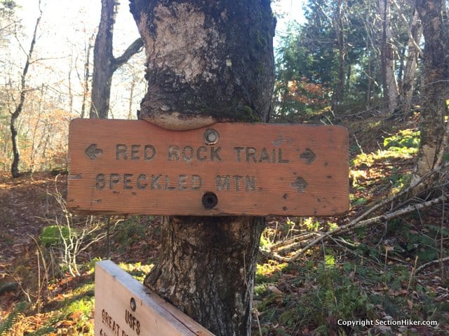
I was looking for a very distinctive trail sign that had grown into the tree it was attached to. It looked a bit different from the sign I had seen earlier in the summer, newer and less weathered. Hard to say if it has changed.
I had a snack, some water and made my way gingerly back down the Great Brook Trail, trying not to fall on my ass in the deep leaves.
I know I’ll be coming this way again. Hiking on the Maine White Mountain Trail system is a real adventure. This trail is quite close to Cold River Camp and I think hiking to the falls will be a good destination for guests when I work as a guide there again, next summer. Not too hard, but scenic for adults and children wanting to stretch their legs and visit a nice waterfall.
Round trip distance 7.4 miles with 1500 feet of elevation gain.
Philip – keep these unusual destinations coming. I’m learning a ton about many of the less trodden places in the White Mountains from you. These all look like great places to explore!
They are fun hikes, that’s for sure.
Not sure I will ever get to enjoy these however I am interested in how you acquired and made available the PDF of the topi map. Really neat. Would like to replicate that approach for trails in northern Maine throughout the St. John Valley.
imported a GPX file into the Caltopo.com navigation tool. It’s free. Then just printed to PDF.
Merci