SectionHiker.com Backpacking Gear Reviews and FAQs
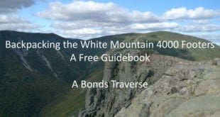
 The Desolation Loop is a moderately strenuous 41 mile backpack through the eastern half of the White Mountain’s Pemigewasset Wilderness, bounded by the Bonds, Ethan Ridge, Carrigan Notch, and Hancock Notch. There are many excellent swimming holes and wilderness campsites along the route, which will …
Read More »The Desolation Loop Trip Plan: Backpacking the White Mountains 4000 Footers Guidebook