
While I enjoy hiking solo in the White Mountains in summer, there are a few trails that I won’t hike alone, in any season for that matter. The Huntington Ravine Trail is one of them. This trail, which climbs a cliff face on the east side of Mt Washington, is considered the hardest and most dangerous trail in the White Mountains of New Hampshire, which is quite a feat, since there are dozens of ass-puckering trails here that have similar billing.
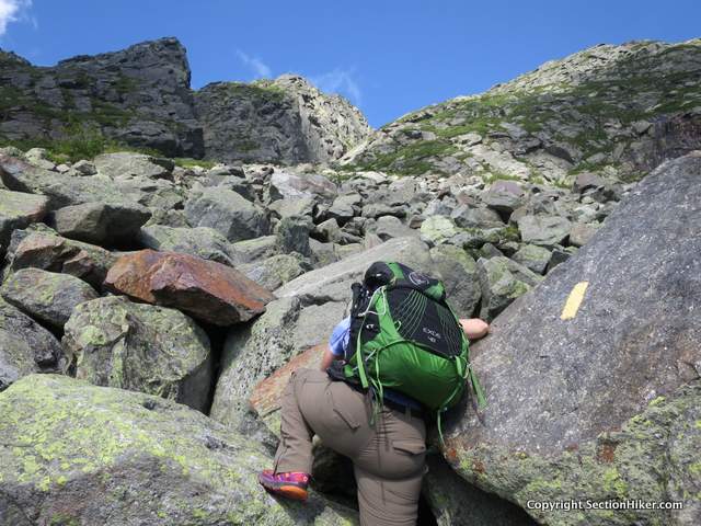
My partner on this hike was Beth, trail-name Damselfly, who’s a tough-as-nails hiker, bushwhacker, and backpacker that I’d met on a winter bushwhack years before on Mt Kancamagus and who’d provided me with valuable route beta when I bushwhacked Scar Ridge. Like me, she’s on a mission to hike all of the trails in The White Mountain Guide. It’s a variant of section hiking, but local to the White Mountains, which has 608 trails that total 1440 miles in length.
We’ve both tried to climb the Huntington Ravine Trail in the past, but had multiple trips canceled due to bad weather when the wet rocks that form the trail are best avoided. Covered with ice and snow over half the year, when full-on technical ice climbing or rock climbing gear is required, there are only a few months of the year when the trail is passable by hikers, making it an elusive and difficult trail to ascend. Descent is not recommended during any part of the year, without climbing gear. See The White Mountain Guide for details.
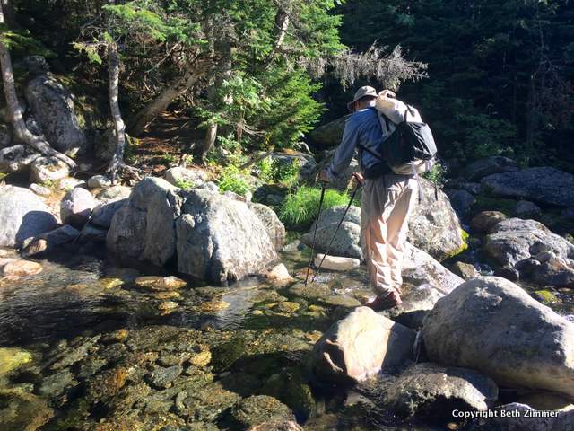
However beautiful clear weather was forecast for the day of our hike. We got an early start, hiking up the Tuckerman Ravine Trail to the lower section of the Huntington Ravine Trail that leads to the base of the cliff face. We soon passed the avalanche rescue cache for ice climbers and took a food and water break in the shade at the bottom of The Fan, the rocky boulder field that forms the base of the cliff.
Beth led the climb after our break, scrambling between and over the boulders carefully, following the yellow blazed trail painted on the rocks. It was slow going, not your average hiking trail, but typical of the above treeline scrambles you find on Washington and the peaks in the Northern Presidential Range – Jefferson, Adams, and Madison.
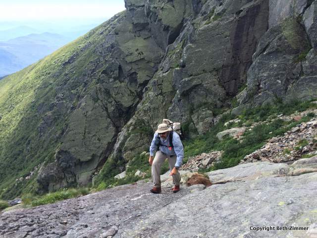
So far so good. We were able to elude some lingering wet spots on the rock, but the trail became increasingly vertical as we climbed higher. We hugged the rock face closely keeping our center of gravity away from the open ledges, jamming our hands and feet into cracks and seams between the rocks for better purchase.

The Pinnacle, a huge tower of rock, loomed to our left. We saw no other hikers ahead or behind us during our ascent, just a pairs of rock climbers climbing the precipice.
I switched off with Beth when we reached a difficult chimney. I climbed up first and pulled her backpack up so she could climb it unencumbered. The top was in sight and we scrambled up an avalanche slide, coming to the huge cairn at the top of the cliff where the Huntington Ravine Trail meets the Alpine Garden Trail. We were on level ground again. We bumped fists and took a break, feeling great and energized for the next part of our journey.
Being tracers, we both had separate routes planned for the remainder of the day: I had trails to hike on Washington’s flanks that she’d hiked already and she had trails to hike that I’d already completed.
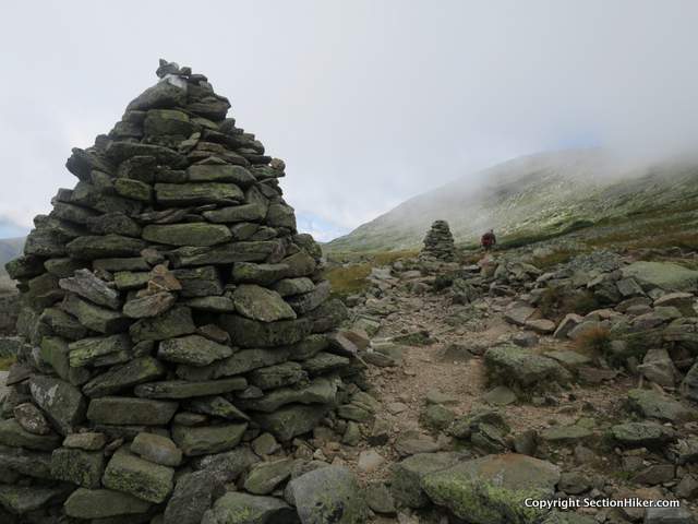
The weather started to deteriorate as soon as we’d topped out at the Alpine Trail, despite a sunny forecast, so typical of Mt Washington which has unpredictable weather. Cold fog soon enveloped us, turning to heavy cloud, with gusty 35 mph winds and dry lightning later in the afternoon.
Beth planned to hike down the Nelson Crag Trail and back to the Pinkham Notch Visitors Center, while I planned to hike up the Nelson Crag Trail to the Mt Washington summit, before looping around Washington on the Crawford Path, crossing the Bigelow Lawn, and hiking down Boot Spur and the Boot Spur Link to the floor of Tuckerman Ravine. We hiked the remaining, easy part of the Huntington Ravine Trail together (0.3 miles), and parted ways promising to meet up again soon. We’d made a good team.
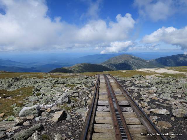
I summited Washington, climbing over a section of the Cog Railroad and refueled on potato chips and cokes in the summit cafeteria. There was a mob of people on the summit that day, so I soon fled to the solitude of the Bigelow Lawn, a huge expense of alpine grass on the wide plain between Washington, Mt Monroe, and Boot Spur, one of Washington’s subsidiary peaks.
I really love the lawns on Washington and the Northern Presidentials. There’s something about the lines of rock cairns that stretch out across them to the horizon, that appeals to me.
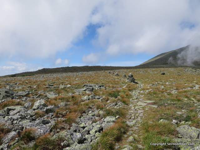
I hiked across the lawn a few times, covering the trails I’d never hiked before including the Southside Trail which wraps around the south side of Washington’s summit cone, the Lawn Cutoff which connects the Boot Spur Trail to Tuckerman Junction at the top of Tuckerman Ravine, the Tuckerman Crossover Trail which links the Lakes of the Clouds Hut to Tuckerman Junction, and the Camel Trail which links Lakes to the Davis Path.
By 4 pm, the sky had turned ominous looking and a strong breeze had started blowing cold fog across the lawn. I felt a few drops and hoped I’d get down below treeline before it started to rain or thunder.
I hiked over the summit of Boot Spur and started to climb down the northwest side towards Pinkham Notch, planning to hike down a steep side trail called the Boot Spur Link which leads to the base of Tuckerman Ravine at the Hermit Lake Shelters.

I’d been warned that the Boot Spur Link Trail was steep, but it provided a very fast escape route below treeline. Just as I reached its bottom, I saw a few flashes of lightning over nearby Tuckerman Ravine, a good time to be down on the ravine floor surrounded by tall trees. I was soon on the path back down to the Pinkham Notch Visitors Center and on my way in search of a pizza to refuel and savor the accomplishments of the day.
Total distance: 13 miles with 5000′ of elevation gain.
Mt Washington, Huntington Ravine Trail, and Boot Spur Loop Map
 SectionHiker.com Backpacking Gear Reviews and FAQs
Looks like you got good weather for the ascent. I can’t tell you how many people I’ve stopped from trying to descend via that trail. Idiots! Need to read the White Mountain Guide first.
Funny you mention that. Beth and I stopped someone from climbing down, or attempting to. Maybe they should put a small sign at the top warning people off. Surprised more people are killed there.
I have an article coming out later about the White Mountain Guide that you’ll relate to.
In the 1970s during the summer I and three others climbed Mount Washington via the Huntington Ravine Trail. The White Mountain Guide says it takes a little over 7 hours. We made it in 5. Made it back down the same trail in 3.5 hours. The funniest part about the climb was when we reached the summit the first thing we saw was a sign that said, “Drink Coca-Cola” atop the Mt Washington snack bar.
Nice trip report. I’ve been wanting to complete that hike for a long time. I’ve been turned around by bad weather there, as well as turned around by bad weather in the winter on other routes… hope to summit that mountain on foot sooner or later!
Great hike. Did it some years ago with my wife and twin 9 year olds.
These days the lads are 20, and each winter we run up head wall. Kids just love that winter weather.
If you say so. They must be pretty accomplished ice climbers now.
Do you remember how tall they were at that age? I am 64 and thought I was 4 11. The other night, I was standing in front of a full length mirror with my daughter and saw things have changed. Got the tape measure out 4 9! My first reaction was “Now I get out of doing Huntington!” All kidding aside, still want to try if I am not too short.
One of my most memorable hikes ever….. and couldn’t have asked for better company!
Indeed a tough one. I hiked the H Ravine Aug 2015 the day after I did the Mt Washington bike climb
Lucky for me the weather was great for both ascents. But the H Ravine is the hardest climb I’ve done
That looks like an amazing hike! I wish I lived closer to places like that to hike. I live in Texas and all we have are hills lol. This past summer we went to Guadalupe Mountains National Park here in Texas, it was the closest I got to hiking mountains; but it’s in the desert and it was summer time! Mornings were nice but about 10am the heat was horrid!
I’m in a part of Texas that requires a pretty good drive to any rugged hiking areas. The Texas mountains are much better hiked in winter. From Thanksgiving to mid March, you’ll have pretty nice conditions. Around the turn of the year, Big Bend’s typical weather will be around freezing at night and in the 50s to 70s in the daytime. Of course, winter storms can take the conditions way down but there is usually a few days notice before one of those hits.
I loved this hike when i did part of it a few years back, it is sketchy but is a blast and a must in my book.
Years ago I made the mistake of descending down the Dudley trail off of Pamola peak on Katahdin after crossing the knife edge, it seemed the best way to Chimney a Pond campsites. I was already committed and maybe half way down when I had many more experience hikers ascending up Dudley ask me why was I going down, that it was very steep, and not recommend. How was I to know? I guess my point is, to do the research.. Many trails up, are much more dangerous down. Thanks for the heads up on the Huntington Ravine trail.
Accompanied by 2 other friends, we completed the Huntington/Summit/down by way of Tuckermans loop this past Saturday the 15th of October. If there is any person out there that thinks this is a cake walk, better reassess! This was an incredible hike and one I will always treasure as “The best of the Whites”. It’s now Tuesday and my calves and shins are still sore from all the toe climbing on the rock face. I’d do it all over again tomorrow given the chance. It’s not for the timid and poses a variety of challenges. Worth every second!!! See you on the trails!
Hey there! Curious about dogs doing going up Huntington… I know most people would say “no way” but hear me out, I have a Siberian husky who has no issues hiking and has hiked many rock scrambles and has done the presi’s traverse. He loves it, I bring plenty of water and food, but obviously I want a second opinion. I mean this dog is made for the mountains, but obviously I would like to hear others opinions. He is off leash 100% by the way and we hike about 3-4 times a week.
If you need to ask me, you’ve already decided.
Huntington Ravine Trail is one of the few trails in the whites where one can slip and fall and fatally fall. The same is obviously true for a dog.
There are many more than that. Here are just a few: Great Gulf Trail, Tuckerman Ravine Trail, Carter Ledge Trail, Webster Cliff Trail, Bondcliff Trail, Willey Range Trail, Six Husbands Trail, Table Rock Trail (the one outside north conway and the other one in Dixville Notch), the Brook Trail, etc. etc.
I hiked the Huntington in August ’17 with my wife and 80lb lab. I’d hike the trail again, but would change 2 things.
1. Leave the dog at home. Shortly after the fan my dog’s foot pads had torn off. His nails had become filed down to the quick. He became dead weight. I found myself pulling him up many of the cliff faces by his leash. My foot legged buddy and I hitched a ride down the Mt and he couldn’t walk comfortably for a week after.
2. Bring a climbing harness and rope. It would have made things easier and safer.
say what? Dead weight or was he in contact with the rock face?
thanks for using the term “trace”!
Cool! I hadn’t realized you did a write-up on Huntington. My son and I will be staying at Lake of Clouds mid June. If we get a nice enough day this is the path we’ll go up – otherwise we’ll follow Old Jackson up to Nelson Crag. Looking forward to seeing the Alpine garden in bloom!