 SectionHiker.com Backpacking Gear Reviews and FAQs
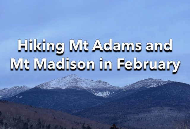
February is the height of winter in New Hampshire’s Presidential Range and it can be difficult to find a weather window where the temperatures and wind speed are safe to climb the higher peaks. I’d passed up a few opportunities the week prior when the wind speeds were too high for my liking and I was resigned to waiting until next year in order to climb Mt Adams (5793′) and Mt Madison (5367′), the second and fifth highest peaks on the White Mountains 4000 footer list.
So when I woke up on Monday morning (Washington’s Birthday) and saw that the wind speed on Mt Adams was forecast to be 11 mph the next day, which is very low, and that it would be in the 20’s (F) and sunny, I decided that I’d climb the Adams and Madison, which are adjacent, then. I texted my friend Lynn to see if she wanted to come and she responded by inviting me to join her, our friend Rick, and his friend Al, since they were planning to climb the peaks too.
Lynn, like me, is working on the White Mountains 4000 Footer Grid, a peak list where you climb all 48 of the White Mountain 4000 footers once in each calendar month (48 x 12) for a total of 576 summits. Rick and Al, have already completed one round of The Grid and are working on their second round. I’ve known Rick and Lynn for well over 10 years and looked forward to meeting Al as well. You couldn’t ask for a better and more experienced crew to climb Adams and Madison in winter.

We met the next morning at the Appalachia Trailhead at 7:30 AM which is a very civilized time to start a winter hike (which often start at 5:00 or 6:00 AM when the days are short). We decided to climb the Valley Way Trail to treeline because we’d read reports on NETrailConditions.com that the trail was broken out with a surface of packed snow and ice. That meant we could leave our snowshoes in the cars and climb with Hillsound Trail Crampons, with full crampons in reserve, in case they were needed in the alpine zone to summit the peaks.
The forecast called for deteriorating conditions in the early evening with elevated winds and snowfall, but we had a nice-sized time window to finish the hike and get below treeline again before the weather blew in. The plan was to climb to the ridge and Madison Hut, ascend Adams, backtrack to the Hut, then climb Madison, and then descend back to the Appalachia Trailhead. The total distance of our route was 10.4 miles with 5050′ of elevation gain, but we expected to get back down below treeline by mid-afternoon. We’d still have a multi-hour hike downhill but we’d be protected by mountain vegetation and be out of the wind once we dropped off the top of the ridge.

The trail conditions were ideal as we started our climb, wearing Hillsound Trail Crampons for traction all the way to treeline, and the Madison Hut shortly thereafter. The hut is closed in winter, but it’s a good landmark in the col between Adams and Madison and can be an important windbreak depending on the wind direction. It took us just under 3 hours to make the ascent.

After consuming some food and water, we set off to climb Adams first because it is the hardest of the two peaks and would take the most time to climb. If for some reason, we needed to bail early, we’d get Adams, but could leave Madison for another day. Madison is much easier to summit than Adams and less dependent on weather conditions.

From Madison Hut we climbed the Gulfside Trail which was a mixture of ice and frozen snow to the Airline Trail which we followed up to the Adams summit. The final section of that trail is a huge, steep boulder field. But winter makes it a lot easier to climb because the gaps between the rocks are filled by ice and snow. You still need to be careful when climbing it to avoid an uncontrolled slide, but you can venture to the left and right of the cairns marking the “trail” to find the easiest terrain and slope angle to climb.

Once at the summit, we paused for photos and took in the grandeur of nearby Mt Washington and Mt Jefferson. Rick, Lynn, and I changed into full crampons for the descent, but Al opted to stay in his Hillsounds.

We reversed course and hiked back down to the Madison Hut, where the Osgood Trail starts and climbs Mt Madison. While the ascent from the hut to the summit of Mt Madison is only about 500′, the route was much icier and I was glad I was wearing my Grivel G1 Crampons because they penetrated the steep ice and provided great traction. We climbed slowly though because we were feeling the strain of having already climbed some 5000′ with full winter gear, food, and all the water we needed to get through the day.
It was sunny and warm on the summit but a bank of clouds was blowing in from the northeast, as predicted. We still had time before it arrived, but it was time to get going. We started our descent, first to the hut, and then down the Valley Way Trail which we’d climbed earlier in the day.

When we passed the Valley Way Campsite, which is a short distance below treeline, we changed out of full crampons and back into our trail crampons, which are more comfortable to wear. You can also zone out when wearing trail crampons, which are just aggressive microspikes. When hiking in full crampons, you need to consciously raise your feet each time you take a step so the spikes don’t catch on the snow or ice and trip you up. With trail crampons, you can just shuffle along and ignore your footwork because the spikes are so much shorter and less penetrating.

By the time we go down to 3000 feet, we could start to hear the wind blowing harder above treeline. We’d timed our hike perfectly. This was also a special hike for Al and me because we both finished hiking all 48 of the White Mountain 4000-footers in the month of February (over multiple years) for our Grids. Adams can be a very difficult peak to climb in February, but we’d lucked out and had pristine weather.