
I got back from the UK a few days ago after a 3 week hiking trip which included backpacking across Scotland with my friend Martin Rye in the 2013 TGO Challenge and a trip to the Lake District to visit Heather and Alan Rhodes of Pacerpole. I had a fabulous time and can’t wait to go back.
Here’s part 1 of my 2013 TGO Challenge trip report. Our hike lasted 13 days and covered close to 250 miles, ending in the seaside town of Montrose on the east coast of Scotland. It was a moderately difficult route through some fairly challenging, but not unexpectedly bad weather, as far as May in Scotland goes. I wasn’t really that phased by the daily rain, sleet, snow, and hail we endured the first week, but walking through ankle deep snowmelt got old pretty quickly. The weather improved markedly for the second half of our walk east of Braemar with less precipitation, although windy conditions and cool weather prevailed.
Still, it was a great route, even though we had to exercise some of our Foul Weather Alternatives, and I got to experience several regional ecosystems that I’d never visited before. Backpacking across Scotland is the BEST way to get to know the country, especially the remote bits that you can only get to on foot.

Days 1-6: (click for Days 7-13)
Our start point was the tiny village of Torridon, located on the west coast of Scotland at the foot of Liathach, one of Scotlands most famous mountains. The scenary in the surrounding hills is breathtaking if you enjoy climbing mountains and taking in big views, making it one of the most popular hiking destinations in Scotland.
However, getting to Torridan is a bit of a Challenge itself because it is way off the beaten track and doesn’t have regular train or bus service. So, I took a train from Inverness to Strathcarron, another very small hamlet in the Highlands, and walked 12 miles through the hills to get to Torridon a few days before the Challenge began. It was good to stretch my legs after flying from Boston to Dublin and Glasgow and taking a train to Inverness the previous day. That hike was rather interesting because the wind was really blowing and I was carrying 8 days of food into Torridon, including 6 days worth to hold me over until our first resupply stop on the Challenge itself.
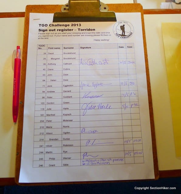
Torridon is the northernmost location that Challengers can start their cross country hikes from (see this post on the TGO Challenge for more information about this annual hiking event) which begins when they sign out on the first day. There were about 20 other Challengers starting from Torridon, many who I’d met in 2010 on my first Challenge hike, and others I knew online or by ‘reputation.’
My hiking partner Martin Rye arrived the night before we were to set out, but my friend Grant Sible who was to accompany us had to pull out at the last minute due to an intestinal parasite. It was a last minute decision, since we’d travelled north together from Glasgow and parted company in Strathcarron when his symptoms got worse. It was a hard call but the right one given the difficulty of our route, it’s remoteness, and the need to put in big miles the first few days to reach a resupply point. Grant went on to get medical care in Scotland and continues to recover back home in Austin.
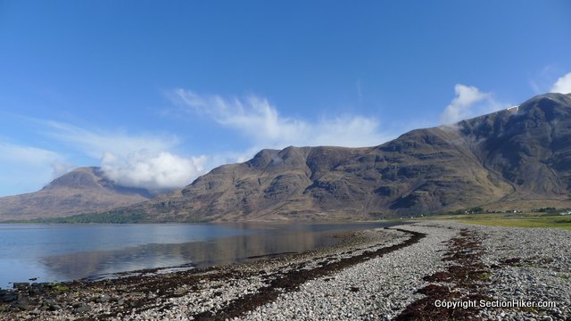
After signing out, Martin and I walked to the other side of Loch Torridon and dipped our toes in the sea before we started hiking into the hills. The weather was clear, but that changed quickly and it started raining just a few hours later.
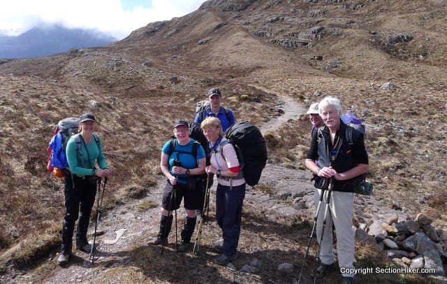
After visiting the Loch, we caught up with several other Challengers headed in the same direction as us including Julie Harle, Ali Ogden, Gordan Green along with a few former Challengers who didn’t get into this year’s event but were tagging along with friends for a few days. I’d met Julie, who’s from the US, on my last Challenge in 2010 and Ali and I had corresponded before when I got permission to use some of her photos in a blog post about the TGO Challenge a few years ago. I’d met Gordon over dinner the previous night and shared a room with him at the Torridan Youth Hostel the night before. Although we all split up the next day, we kept running into them and other Challengers later in our hikes, which is pretty normal because the geography tends to funnel people together as you head further east.

My hiking partner Martin (who I’d hiked the 100 Mile Wilderness with last summer) was remarkably fit for this Challenge, although he’d strained his calf muscle a few days prior to the start and had considered pulling out at the last moment. I’m glad he didn’t because I got to walk across a lot of high moor, peat bogs, and grasslands that I hadn’t previously had much experience traversing. Martin taught me a lot of route-finding, energy conservation, and footwork skills in this kind of terrain, preparing me for much more difficult overland routes across Scotland in the future, and without Martin along, I would have had to make significant changes to the route we’d planned.

Leaving Torridon, we walked through one of the most magnificent glens or valleys in all of Scotland between Coire Grannda and Coire Lair. It started to rain and the mist came down just before we entered the pass which is bordered by two big mountains Sgorr Ruadh and Beinn Liath Mhor. It was tempting to climb Sgorr Ruadh which has a knife edge summit but I was feeling quite burdened by 6 days of food and watching the mist descent over the peak dampened my spirits because it meant no views for the effort. Still walking down the pass to the road crossing at Achnashellach was mind-blowing and there are a few walks I’d like to do here when I come back to the area.
That night, we all camped together on a spit of land next to a burn (stream) under the cliffs of Sgurr nan Ceannaichean, pitching our tents and shelters in the pouring rain. I cooked up a filling dinner of Packit Gourmet Polenta and fell asleep quickly, waking up at midnight to see that the water in the burn had risen all the way up its banks and was close to overflowing. As I lay there, I thought about moving my tarp up to higher ground but I was too tired to bother and there weren’t really any good pitches nearby anyway, just a sea of heather. I fell back asleep quickly and saw that the water level had dropped by morning.

That day, we all split up and went our separate ways, heading toward Montrose along different routes. Martin and I quickly caught up to another first time Challenger named Mark who was nervous about the stream crossings on his route and joined us for the next two days. We saw him a week later in Braemar on the edge of town, a big smile on his face, with tales to tell.
We first met Mark at this wire bridge which Martin and I watched him cross successfully, although there were a few moments when he looked like he was going to fall off. There was no way I was going to try to balance on those two wires and Martin and I just walked across the stream in our mesh trail runners, the water only coming up mid-calf on our legs.
After that Mark tried to keep his boots dry for about a day, but I think he just gave up at some point. There was just too much snowmelt flowing down the hills and into the glens to even try. It made for a lot of nice waterfalls all around though.
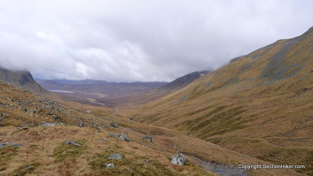
We spent much of our second day walking off track in rain and on bearings through the steep glens. The ground was extremely wet and our feet were continuously soaked, so much that we joked about the Challenge being an excercise in carefully controlled hypothermia, which wasn’t that far from the truth.

Those first few days, it rained, sleeted, hailed, and snowed everyday and I had to wear my waterproofs and most of my clothes to stay warm. Martin had insisted that I bring a 100 weight fleece to wear under my shell and keep the chill off me and I ended up wearing it every day of the Challenge. Good call, that.
We were also doing pretty big miles each day, hiking 10-12 hours continuously with few breaks, and eating as we walked. It was just as well because we managed to get a bit ahead of the really bad weather that a lot of the other Challengers experienced this year, including one day of continuous torrential rain which fell when we were enjoying a zero day in Braemar.

We pitched up in the rain again on our second night after taking a short cut across several more miles of bog. People complain about walking through bogs and over moor but I really fell in love with it during this Challenge. If you know how to pick a good route through it without getting sucked into the soft peat, it really opens up all kinds of routes that you’d miss out on if you just stick to well known paths or Land Rover tracks. We spent about 6 days total walking over boggy ground and I grew to enjoy it.
Our camp that night was fairly windy, although we got some protection from a nearby hill. Worse than the wind were the tussocks of grass, mole hills, and sloped ground that I had to contend with each night under my pyramid tarp. I became quite envious of the bathtub floor that Martin had had made for his GoLite Shrangila-3 that kept him from sliding out under the wall of his shelter at night. I was sleeping on a slippery UL polycryo sheet and had to arrange my pack and food bags at night to keep from sliding off it. This scheme worked pretty well but it got real old by the end of the Challenge.

We continued heading south on day three, making our way to a munro named Mam Sodhail, which I attempted to climb on my last Challenge in 2010. We arrived as the mist was coming down over the peak and opted to bypass it by heading over a high mountain pass named Bealach Coire Ghaidheil and down into Glen Affric. I climb for views not just to tick a box, and besides the added risk of climbing mist-shrouded munros (over 914 meters in height), there is little satisfaction in climbing a peak when you can only see your feet.
Skipping Mam Sodhail required a detour around the base of the mountain including a long walk up Loch Affric and Loch Beinn a’ Mheadhoin along forest tracks designed for Land Rover use. It was more mileage, but we were able to hike over the tracks at close to three miles an hour making very good time.

Still the hard surface of the tracks hurt my feet and by day’s end, I developed a very painful blister on the ball of my right foot under the big toe. The blister was caused by grit suspended in the streams we’d been crossing that had been collecting in the insoles of my shoes.
I was less concerned about the blister and more concerned about running out of socks. The grit trapped in my shoes had been chewing through a pair of socks per day creating gaping holes under the heel and the ball of my foot. It got so bad, I started wearing two pairs of the chewed up socks at a time in order provide at least one layer of seperation between my skin and my shoes. At the current rate of sock lossage, I’d be out of socks by day 4 of the Challenge.
We camped that night at a fairly crappy pitch on some waste ground by a farm, although it was close to a stream where I washed out my shoes and socks. I was beat and fell asleep immediately after dinner, just as the rain started coming down again.

The next morning, my blister was feeling better but we decided to take an easier route to get to the town of Drumnadrochit on the west coast of Loch Ness. This involved hiking along some high moor and forest tracks to bypass the Balmacaan Forest before forking off along some easy road walking through the forests and farms in beatuiful Glen Urquhart.

My main concern that day was in finding a few pairs of new socks on the west side of Loch Ness before we took the ferry across and what I’d be eating for dinner at that night at Ault-na-Goire, a croft we planned on stopping at for the night which serves hot cooked meals to TGO Challengers.
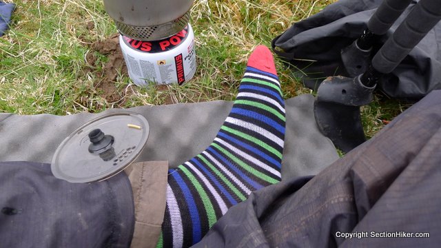
After an early start, we arrived in Drumnadrochit at about 2:30 pm, where I was able to find two pairs of synthetic Nessie Socks (embroidored with the monster’s likeness) in a tourist shop. These got me through another few days until I could buy 5 real pairs of hiking socks in Aviemore at the edge of the Cairngorm mountain range. I also picked up a box of Compeed Blister Patches and Molefoam which provided immediate relief and helped prevent the blister from opening up or growing in size.

With the socks and blister relief sorted (and a hot bacon buttie) we hiked up the road to the pier where we’d catch the ferry across Loch Ness, the only motorized transport that Challengers are permitted to take during the event. The ferry was late in arriving at the dock however, and the captain was very reluctant to take us across that evening due to high winds and 4 foot waves. He suggested driving Martin, myself, and several others around the Loch which I feared would disqualify us, but in the end acquiesced to ferry us across despite the bad weather. Despite the high waves, the crossing was uneventful. We disembarked and quickly hiked the mile uphill to to the croft at Ault-Na-Goire and what I hoped would be a sumptuous dinner.

Unfortunately for me, the croft had cats which I am deathly allergic too, so I had to pass on dinner and cook my own under my tarp. Julie, who’d started at Torridon at the same time as Martin and I, also decided to skip dinner and eat in. She’d pitched her tent next to mine in the croft’s field, so we carried on a long conversation, each of us zipped up under the flies of our respective tents to block out the high winds while we cooked. We had a great talk about the joys of early retirement and our current lifestyle even though we were both “under canvas” the entire time.
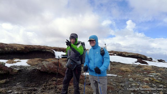
The next day we headed into The Mondaliath, a mountain range that consists almost entirely of high elevation moor and peat bogs. It can be a disorienting and difficult place to walk because its featureless round hills provide few landmarks. Good navigation and compass skills are a must have, especially when the mist comes down. I must admit, Martin convinced me of the utility of carrying a Cell Phone GPS with ViewRanger on it in The Mondaliath. It comes wth really good UK maps and I’m already experimenting with its US map set.
On the way there, we hooked up with a Challenger named Jon Hancock that Martin knew, and who joined us for the next few days. Jon was sporting a UL setup on this Challenge hike including a custom Zpacks cuben fiber backpack, a classic Gossamer Gear SpinnShelter, a sleeping bag augmented with a down vest and insulated pants, and a GoLite umbrella. We got to talking and had a wonderful time getting to know one another. He’s had some pretty interesting life experiences including a stint as an overnight camp caretaker in a remote part of Maine, which he descibes as reminiscent of “The Shining.”
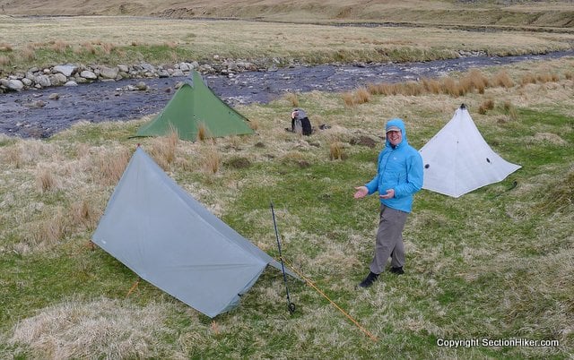
That night we camped along the banks of the River Findhorn, which Martin descibes as the most dangerous river in Scotland because it has a large watershed and comes up so quickly when it rains. It was windy again but we found a semi-protected pitch close to water, although it was colored brown and tasted tannic from the peat.
I watched Jon pitch his SpinnShelter, a tarp shelter that I could never get the knack of pitching myself, but have always appreciated as a UL design classic with its oft-copied front vestibule and copious tie-outs. Jon is very skilled at pitching it in windy conditions which is a subtle art-form that requires considerable practice. He got a lot more during the days we hiked together.
The next day, we set out for Aviemore to resupply and to get out of the weather for a night at the local youth hostel. I was looking forward to my first shower in 6 days and a chance to thoroughly dry out my gear, which had gotten a bit damp after days and days of foul weather.

We crossed the River Findhorn over a well-constructed concrete bridge (many highland bridges are washed out each year during the spring floods) and passed through a wealthy landowner’s estate, complete with a castle and a private Loch, passing a herd of wild goats with their curved horns. From there, we climbed back up to the high elevation Mondialiath moorland until we came to a long hard-packed track called the “Burma Road” by the locals because it’s so tedious to walk. This dropped us into the outskirts of Aviemore, a very small town complete with beer, a supermarket, cafes, gear shops and an Indian restaurant. We were in heaven.

 SectionHiker.com Backpacking Gear Reviews and FAQs
Hey Philip,
I happen to be home for a few days and glad I was able to catch up and check out this trip report.
The TGO is one of those hikes that someday I hope to be able to do.
So all in all, are you happy with the path that you choose from the get-go??
definitely. torridon is a great place to start and I would be tempted to start there again, although I’d go a week earlier next time to hike more in the local hills BEFORE the Challenge starts.
Enjoyable read. A number of people have been commenting on problems grit cause on socks and feet.
I enjoyed that Phillip. I too had to wash out my socks and shoes each night as they would quickly fill with grit. Thankfully no blisters though, although my socks are now a bit threadbare.
I wear thin wool sock liners, but experimented with thicker socks later in the walk. The grit became less of a problem though during week 2 so I ended up walking with 5 pairs of socks in my pack. Part 2 is in the works – including a picture of you at dinner.
Really enjoyed meeting you James – hope we can hike together some day.
It was good meeting you too, enjoyed chatting with you over the dinner in Montrose.
Look forward to part 2.
Hi Philip
It was lovely seeing you again this year. What a great write-up!
Just a small correction: That pass isn’t the Coulin Pass, it’s the pass between Coire Grannda & Coire Lair. The hill on the right is Sgorr Ruadh.
Looking forward to Part II
:-)
All the best
Alan
I thought so – I was just looking through “someones” hiking guide to NW Scotland last night – thanks for the correction. Will edit.
Veda cool and definitely hard core. I mostly trail hike but reading about trips like these make me want to try off trail more.
–louis
Off trail is a lot easier when there aren’t any trees in the way. :-)
Wow, that old-growth tree is incredible.
It’s not even the biggest.
Hi Philip,
It was great to meet you and to share the magnificent scenary on our start from Torridon.
It has to be one of the best start points for the TGO.
I’m enjoying the write up and look forward to the next part.
Cheers,
Gordon
Great first installment! The TGO challenge is definitely on a life list for me.
Would love to see a post on your gear choices – maybe broken down by what you brought, what you were recommended to bring and were glad you did and what you didn’t bring but wish you had.
Brain – here’s my gear list from before I left.
https://sectionhiker.com/scotlands-tgo-challenge-gear-list-2013/
I am planning on doing a gear that worked, gear that didn’t stype post in a few days. I definitely brought a few things I didn’t use or need, but all the important items worked well.Stay tuned,
Philip nice recap and it was a good trip. I think the weather as an average May. I enjoyed your friendship and sharing the hills with you. Well you’re more able to go do a big solo walk now and have those key skills to make it work well. Get applying.
Big solo walk next time, but I’m not sure I want to stay in the Challenge boundaries. The northwest beckons.
JMT? I’m hoping to do that next summer if my boss will give me a month off.
No – uh northwest Scotland. I’m not interested in hiking anywhere you need to get a permit. No bears, too.
Yeah, I was wondering which “northwest” you meant. Why do you avoid permits?
I hate filling out forms and beaurocrats. The thought of being told where to camp and on which day takes all the spontaneity out of an adventure where you need to live by your wits or whim. I’m perfectly happy hiking in New England and its mostly unregulated forests, lakes, and mountains. You can go anywhere you want, anyway, and anytime as long as you stay on public lands and they’re pretty vast so you can do some cool trips without asking anyones permission.
Understandable. From what I’ve read about JMT, you only need a permit for the day you start and the rest is up to you. You can camp where you like when you like, I think.
And someone recently told me “Do not die without hiking the JMT.” So I figure I should probably get out there.
But yeah, there are still bears to worry about.
Hi Phillip!
Snap. I’m thinking along the same lines. Each time I have been to Scotland, I’m drawn to the NW. If (when) I return, I’ll likely do the Cape Wrath Trail or something in that area.
BTW, remember finding me near your tent at the Montrose campground? I really was taking a photo, here’s the evidence: https://photohiker.zenfolio.com/img/s9/v91/p1611524447-3.jpg
Cheers,
Mike
An excellent report Philip that captured both your Challenge specifically, and Scotland in general, really nicely. I’ve been up many of those hills in the Torridon and Coulin area but walking through them looked a great experience. You chaps did very well to stay ahead of the weather – I came across Bealach Coire Ghaidheil on the first Monday and there were a few inches of snow lying with much more on the mountain tops! I too chewed through a pair of socks and ended up buying some new ones in Ballater after crossing the Cairngorms – I’m quite sad that I ended up with dull grey ones rather than striped Nessie designs! Fetching :-) I look forward to reading the next part.
A great read thanks for sharing ,looking forward to next instalment.
Look like you had a great trip.
When I see trip reports like this I get really home sick for Ireland and Scotland, I am Irish and halfway in to a 3 year stint at Corporate Hq in Michigan.
I am hoping to attend the challenge next year.
I would love to hear more about the technique for bog walking! Also, I see from the gear list you posted previously that you used Gore-Tex socks, and I’m curious whether you ever used Sealskins to keep your feet dry? (I wished I had one or the other fording streams in the High Sierra.)
Hey Gail – I’m planning on writng about it. It’s really quite an interesting set of skills.
Glad you are, because I was curious about that, too. Gail, I’m currently reading your book. Love it so far!
Great read and welcome back. It appears this trek lived up to its “challenge” name. I am curious about your foot / blister problems. You had written earlier about the wonders of Leukotape. Did it not hold up to the rigors of Scotland moors?
The blister was on the ball of my food just below the crease of the big toe. I didn’t put Leukotape there (I just use it on my heels) because I wouldn’t be able to get a perfect seal against my skin and the edges would likely rub my skin the wrong way and cause more blisters. As it was, I was able to keep the blister intact so the fluid would reabsorb into my skin, which it did and has now formed an even harder patch of skin. I still stand by Leukotape, but I’ve made blisters even worse by introducing tape edges – say between toes – where the edges just make things worse.
Philip,
Great trip report. It was nice meeting you in Torridon and later in Braemar (and of course in Montrose). Your well written write-up reflects many of my experiences during the challenge. Going cross-country through heather and moor was nice and opened up great terrain.
I’m looking forward to the next part of your report.
Stay in touch,
Manfred
P.S.: You might want to reconsider your opinion about the JMT. All it takes is an entry permit. It’s totally up to you how far you hike each day and where you camp. The scenery is breath taking and you can actually see for miles and miles when you walk across the passes. I will do it for the fourth year in a row this year.
That’s good to hear – I stil have problems with the permit thing though. Enough to stay in New England and New York where we’re free of such hindrances. Do stay in touch though and enjoy the JMT with your wife.
Hi Philip,
Thanks for taking the time to share your stories of the recent TGO. I followed you every step of the way :-]
Since you’re not allowed to bring food into GB, how do you work out your supplies and food drops? You mentioned a Packit meal, did this come in England?
You can bring food into the UK, it just can’t be fruit. Not that it matters. My bags have never been searched coming in from Dublin or Boston through Glasgow and there hasn’t even been a customs official at the airport gate.
Hi Philip,
Thanks for taking the time to share stories of your recent TGO. I followed you and Martin every step of the way :-]
Since you’re not allowed to bring food into GB, how do you work out your supplies and food drops? You mentioned a Packit meal, did you get this in England?
This a great summary Philip! It was great meeting you and Martin and I enjoyed walking with you both before we went our separate ways along Glen Affric. Thanks again for waiting whilst I went back to look for my camera, I hope I didn’t delay you too muc, and for the useful backpacking tips. The Challenge was fantastic experience and I’ll do it again some day!
We’ve had some good settled sunny weather here in Scotland since the Challenge. A couple of weekends ago I walked around Loch Treig taking in the four neighbouring Munros and camping on the southern shore near Creaguaineach Lodge. Later this week I am off to Knoydart for six days (staying in the Whitehouse at Barrisdale!).
Hope you have some more trips planned soon!