Bridal Veil Falls is a 80 foot waterfall located near the tiny town of Franconia on the western-most edge of the White Mountain National Forest. It’s one of the most photographed waterfalls in the White Mountains, according to New England Waterfalls, the foremost reference on waterfalls in the Whites.
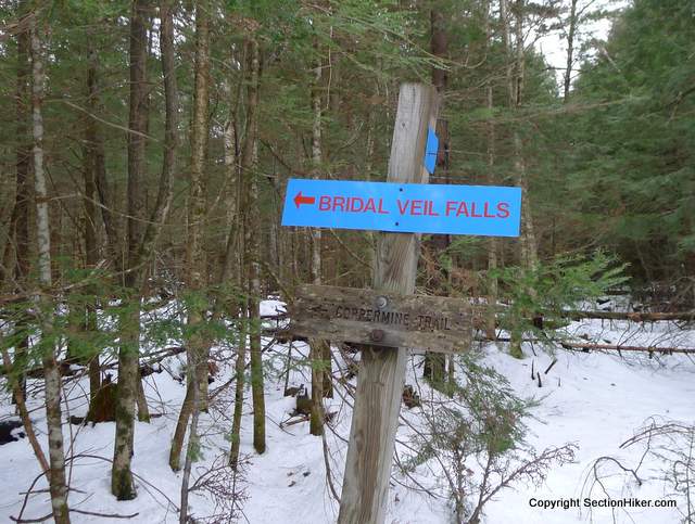
We had a big thaw in the White Mountains and I wanted to see if the falls were running. They’re located at the end of the Coppermine Trail, one of the few trails that I haven’t hiked on the western side of the Whites.
Five miles round a trip with 1100 feet of elevation gain, the Coppermine Trail is a pleasant winter hike up an old lumber road flanked by open forest and the picturesque Coppermine Brook, which was roaring with snowmelt. There was so much water from the thaw, that the trail itself was underwater for a good spell, channelling the runoff down its Irene eroded treadway. All the signs indicated that the falls would be open with a good flow.
There was slushy snow at the bottom of the trail, but not enough to really warrant any kind of traction aid. I couldn’t see the nearby brook, but I could hear it and wondered how big it was.

I left the trail and headed off into young spruce, plunging deep into wet snow to have a look. I was happy to be out on this hike, my first since Thanksgiving, after being sidelined with a bad cold and a lingering cough for four weeks.
The brook was only about 30 yards away and pretty shallow down near the bottom of the trail. But it gets deeper as you gain elevation with several deep gorges and falls. There’s also a trail of sorts, either a game trail or a fisherman’s’ path that runs alongside the brook and provides easy access to the deeper pools. It’s pretty, but it has a very small drainage with no upstream ponds, so I’m doubt there are any fish in it.

My curiosity sated, I bushwhacked back to the trail and continued climbing, only to find that higher up, the trail runs alongside the brook.

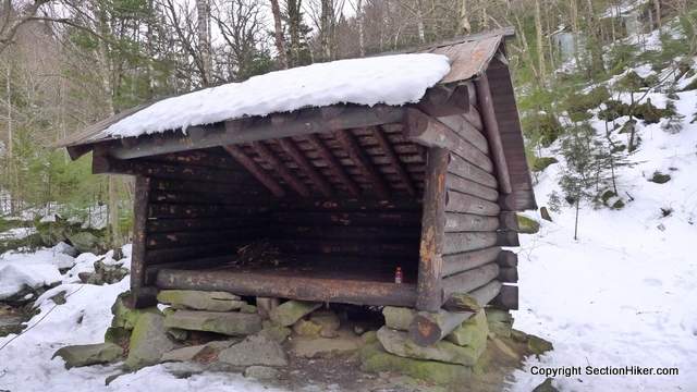
After an hour or so, I came to the end of the trail and the old Coppermine Shelter. It’s completely covered with hand-carved names and messages and not in the best condition. There’s no privy nearby and I doubt the Forest Service will replace the lean-to when it finally falls down.

The falls is a short walk past the shelter. It requires one stream crossing to get to the bottom pool under the falls and a second crossing to get halfway up the falls. I crossed both, which were pretty deep, relying on my insulated single layer Garmont boots to keep me dry.

The upper part of the falls was flowing well, but the area left of it was frozen over. Having never been here before, I don’t know if the left hand side of the falls flows as vigorously in warmer weather, but it’d certainly be worth hiking up here again to find out!
My objective attained, I turned around and headed back down the trail to my car. This was a nice walk, but really just a warm up hike before the big hike I have planned for the following day, a winter ascent of Mt Washington.
It’s nice to be hiking again after my illness.
 SectionHiker.com Backpacking Gear Reviews and FAQs
Philip, been really enjoying your blog for the past few months,good to hear your feeling better and can’t wait for your mt. washington post. looking forward to your 2015 adventures, have a Happy New Year!
Thanks Brian. Nice having you along for the hike!
Very nice. Any trail maintenance issues to report? Any blowdowns? I wasn’t able to get up there to maintain this fall due to having a baby, so hopefully it was all ok (except for major thaws, which do flood a small part of the trail)
No issues Greg. But I do have a question for you. I noticed that ski trail that leaves the Coppermine trail at that sign above. It does have blow downs across it and I was wondering if anyone maintains it, or how such ski trails are maintained in that part of the Whites. Do you know if there’s an organization that oversees it?
Good question – I’m not sure. It seems like they may be semi-abanonded. Quite a few XC trails in that area that have slowly grown in
This is a nice, relatively easy hike. I have heard that there is a plaque a short distance from the Coppermine Trail in memory of actress Bette Davis’s close friend. Below is a link talking about it. https://www.boston.com/travel/explorene/newhampshire/articles/2010/01/17/nh_trail_as_pretty_as_the_falls_at_its_end/