Wednesday was my day off and I was determined to hike, rain or shine. I woke up at 5:00 am and was headed out of Cold River Camp by 6 o’clock, before the morning bell.
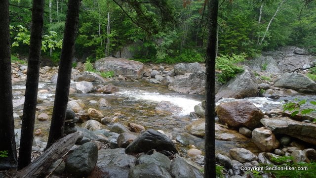
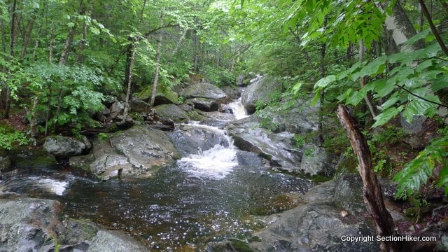
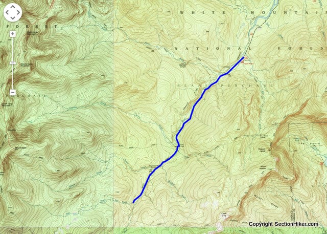
My destination was a section of the Wild River Trail that I’d never been on before. This trail runs along the Wild River, a high gradient stream, which grows into a roaring boulder choked river as it flows north through the White Mountain National Forest.
As I turned down the five-mile long unpaved road leading to the trail head, I saw a young bull moose feeding on submerged vegetation in a big beaver pond by the road. I turned off my car engine and watched while he swam away, disappearing back into the woods. Early mornings are the best for wildlife sightings. I felt like my day was already blessed.

The section of trail I planned to hike is in the Wild River Wilderness, one of the more remote wilderness areas in the White Mountains, with very limited access unless you’re willing to backpack in. Adjacent to the Caribou Speckled Wilderness and Evans Notch, this entire area is as uncrowded and undeveloped as you can get in the White Mountains region.

Conditions permitting, I also wanted to try fly fishing the Wild River for trout, since the River has miles of the cascades, riffles, pools and cold water that trout need to survive. The Wild River is noted for its trout fishing so I brought along my Tenkara rod and tackle to fish a few sections, knowing full well that a longer multi-day trip will be needed to explore the five-mile stretch I intended to hike.

The Wild River Trail, like so many other major trunk trails in the White Mountains, is built along an old railroad grade, originally built to haul clear-cut lumber from the forest. Yet without those old railroads, the White Mountains and its enormous trail system would probably never exist.
The last time I’d hiked the Wild River Trail had been 2007 on an AMC trip I took with my friend Christine Benton. We’d followed the AT south from Gorham, over Mount Moriah and the Carters and down the Black Angel Trail to the Wild River Trail, finishing at the Wild River Campground. That one trip cemented my desire to Section Hike the Appalachian Trail and started my love affair with backpacking in The White Mountains.

That trip was on my mind as I set out on my hike, headed south toward the Eagle Link trail junction where we’d picked up the lower section of the Wild River Trail, on another trip I’d taken the Baldfaces with my friends Guthook and Steve Conlin.
I started hiking by 7:00 am, just as it started to drizzle heavily. Rain was forecast for the day, so I’d expected it, but that doesn’t mean I was looking forward to hiking 10 miles in pouring rain.
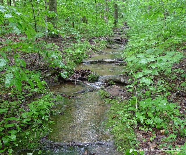
Following the river, the Wild River Trail is an easy hike with a mostly level grade, so I was flying up the trail at a fast pace. Parts of the trail are muddy and parts are quite wet, but none of that is an issue if you don’t care about getting wet feet.

There is a point where a stream crossing is required to the other bank: this occurs at the junction of the Black Angel Trail. I blew right past this junction and started climbing the Black Angel Trail, only noticing my mistake about an hour later when I checked my map, trying to correlate the elevation gain with the gentler gradient I’d been expecting.
I backtracked back to the crossing point and forded the Wild River, which was running a few inches high with the recent rain we’ve been having. I DID NOT cross at the location of the cairns because the pools underneath them were simply too high. There is a shallower and safer crossing point upstream and I suggest you cross there instead.

The Spruce Brook tent site is about a mile south of the ford. It’s a primitive site next to Spruce Brook which flows into the Wild River. I fished the confluence of the river and brook for a while in the pouring rain, since I’ve had luck with this kind of feature, but didn’t get any bites.

If anything, I did start to get cold because my rain gear had wetted out, including the fleece sweater I was wearing under my rain shell. I had a snack, packed up, and continued south to Red Brook, an even larger intersecting water source with a beautiful waterfall.

I tried to cross Red Brook but slipped and fell on the wet rocks along the stream, landing hard on my left hip. I was just 0.3 of a mile from the Eagle Link Trail Junction (my destination) when I decided I’d better turn around. The crossing was just too high consequence and there was no good way to bushwhack around it. No big deal really, I’ll be coming back to this spot again with a fishing rod.
I was wet, cold, and done as they say, so I turned around and hiked out, the 5 miles back to my car.

If you’re looking for a wild spot to play in the White Mountains, try the Wild River Trail along the Wild River in the Wild River Wilderness.

 SectionHiker.com Backpacking Gear Reviews and FAQs
It would have made a nice loop to return on the other side of the river via the High Water Trail. I did that last Fall as I didn’t really want to cross the river, and it wasn’t really plain where the crossing was intended to be. It’s not the route for fishing, but is little used apparently and a pleasant hike. I would like to return to explore more of that wild region. Perkins Notch is wildly beautiful with great views up to the Carters.
I went back later and a bunch of the Highwater Trail, actually, on a different day. Massive damage from Irene, but I haven’t hiked the section yet from the Sherburne Tr to the end of the Wild River. That whole area is pretty cool. Way off the beaten path.
The only part I did was from where the Wild river Trail crosses the river at the Black Angel trail junction up to the suspension bridge just past the Moriah Brook Trail beginning. Last October that seemed in pretty decent shape. Mayne a little more exciting than the railroad bed on the other side of the river.
It’s really cool to see a moose! For all my hiking I’ve never seen a moose in New England (I’ve saw 2 in RMNP).
You can also reliably see moose on Clinton Rd across from the Highland Center in Crawford Notch in the morning below Mt Eisenhower. They’re everywhere actually, watching us and taking notes!
Hike up into Zealand Notch. The beaver ponds where the old railroad yard was below the hut often have moose feeding.
Much more exciting. The far bank and trail from the campground down to the Sherburne trail was largely washed away and rerouted, I also hiked up Bull Brook aways, for a little fishing – good pools – and it had obviously been terraformed as well, but that also could be from the annual thaw.
What are the typical temperatures in this area now?
Go to NoAA.gov and type Bethel, Maine.
Ah, Berlin Municipal Airport. Sorry, I thought you were up in the mountains. Still, even the airport temps are 20-25F cooler that what I’m feeling in central Ark and with less humidity to boot.
Since I happen to know Mr. SectionHiker personally, I’m less inclined to comment as frequently as I might like, but I wanted to reply on what I thought was a perfect blog post. In no particular order, here’s MY review. ;-)
1. It wasn’t too long. I like to spend 90 seconds or so reading articles and looking at pictures. This one was right in the “Goldie Locks” zone.
2. Good narrative flow. It told a story and brought you along from trail head to finish and didn’t deviate too much from the theme. It didn’t get bogged down on some minor issue as some bloggers are inclined to do. (like myself)
3. Photo Captions. I appreciate a pithy yet accurate description of what the picture is trying to say.
4. Photos. Having done a bit of hiking and picture taking myself, I know how hard it is to convey the feeling you get when in the woods. Notice how the camera angle is low on some of the river shots. You get a little more intimacy by moving the camera down to your waist level.
5. Maps. I know the WMNF pretty well but not as well as some. I have a dual monitor setup that I often use to zoom in and out of the map in one screen while following along in the other. This is particularly helpful absorbing the gestalt of bushwhacking posts.
Keep up the great work!
Thanks Zil. Met a few people hiking in the Pemi over the weekend who recognized me and mentioned this post as well. Must have been that moose!
Was just in this area June 2018 – never made it across the river to the Wild River Trail. Came down from Shelburne-Moriah, lost the highwater trail (on river left) dozens of times before losing it completely shortly after the Moriah Brook Trail junction.
Burned all our hiking time bushwacking and looking for the trail (not inexperienced hikers – couple thousand miles and several decades between us) before returning to camp across the river from Wild River Campground. Rained in the afternoon: with that and so much daylight burned, we didn’t attempt the alternative – crossing and heading up to our intended overnight at Perkins Notch.
In the morning, more destruction on an already very destroyed trail. Lots of new trees 12″dia+ in the river, lots more trail sections fallen in!
Wild River area is definitely wild!