If you plan to hike in the White Mountains in winter, it’s important to pay careful attention to the weather forecast so you can avoid hiking in dangerous conditions. High winds, cold temperatures, or deep snow can compromise your safety but can be easily avoided if you track the weather forecast for a few days before any planned hikes.
You’ll also want to learn about the weather patterns in the region and what forecasting tools are available for planning hikes. Winter conditions in the New Hampshire backcountry are so extreme that you can’t simply plan a hike months or weeks in advance and expect the weather to cooperate. I have canceled many winter hikes due to sketchy weather conditions and would encourage you to take a similarly conservative approach.
Weather-Related Hazards
The main weather-related hazards in the White Mountains are the wind, cold temperatures, and snow conditions.
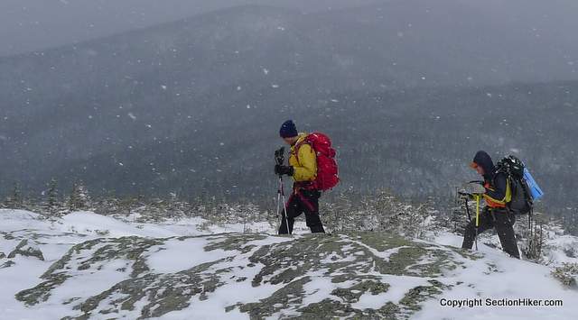
- High wind, over 40 mph, can make walking difficult. It can accelerate heat loss from exposed areas of skin, resulting in frostbite.
- Cold temperatures cause ice which can make walking difficult or dangerous depending on your location.
- Deep snow can be difficult to walk through, resulting in higher energy expenditure if you need to break out a trail with snowshoes or end up post-holing because you didn’t bring them
- Blowing snow or low clouds can obscure your vision, particularly above treeline, in the form of whiteouts and cause navigational problems.
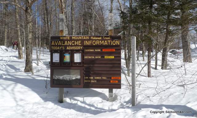
- Snow accumulation can also produce avalanche conditions. Avalanches occur throughout the White Mountains and not just in areas with avalanche forecasts such as Tuckerman and Huntington Ravine. The White Mountain Guide, with over 650 detailed trail descriptions, notes trails that have avalanche zones and other hazards. It’s usually the best thing to read when planning winter routes. If you don’t own one, you should buy a copy. It has directions to every trailhead and is indispensable for route planning in the Whites.

Mountain Weather Forecasting Concepts
A basic understanding of mountain weather and local weather patterns is helpful for interpreting forecasts in the White Mountains.
Wind Direction
The wind in the White Mountains mainly blows from the west. If the wind is blowing from the south or east, it means that moist air is blowing in from the ocean which can result in rain or snow. If the wind is blowing in from the northeast, it is a strong indication of bad weather and heavy snow in the form of a Nor’Easter. Nor’Easters are low-pressure storms centered off the coast and the Gulf of Maine that dump large quantities of rain or snow on the White Mountains and throughout New England.
Mountains Create Their Own Weather
When the wind hits the mountains, it speeds up as it flows over mountain tops. This creates numerous microclimates in the White Mountains, depending on the geography of the terrain, which can have very different weather conditions despite being relatively close together. For example, Tuckerman Ravine often experiences much heavier snowfall than the rest of the White Mountains because it is the lee of Mt Washington, the highest mountain in the region. When the wind hits Mt Washington and its subsidiary ridges, its speed increases, the air cools and drops large amounts of snow into the Tuckerman Ravine Bowl below.
High Elevations are Colder
For every thousand feet of elevation you climb, the temperature drops 3 to 5 degrees. Called the atmospheric lapse effect, this not only has temperature consequences but can also explain why the weather on top of mountains differs from valleys and lower elevations. It also explains why the risk of frostbite and exposure increases at higher elevations when coupled with increasing wind speeds.

Fronts Bring Bad Weather
Fronts – both cold fronts and warm fronts – define the dividing line between two air masses, one of which pushes the other out of its way. When fronts collide there is a change in the weather pattern, usually with bad weather, high winds, and a change in weather direction. Here’s what the interaction between these two types of fronts looks like on the ground.


Warm fronts, associated with areas of high pressure, affect local conditions gradually and often provide observable clues, such as wispy clouds 24 hours before their arrival. Cold fronts associated with areas of low-pressure move in much more rapidly, as fast as 35 mph, and cause rapid dramatic storms, followed by cooler and clearer weather. Knowing which is headed your way and when they will arrive can help you decide where you want to be when they make their influence on the weather felt.
In any case, you can always expect elevated winds when a high-pressure region is replaced by an incoming low-pressure area or vice versa. This information is always contained in the Mt Washington Higher Summits Forecast (written and audio) and the NOAA (weather.gov) Forecast Discussion. You’ll learn a lot by reading them regularly and checking them daily in the days preceding a big hike,
Winter Weather in the Whites
So how bad is winter weather in the White Mountains? It can be pretty nasty and it’s best to be prepared. Checking in on the forecast every day is the best way to do this. Here are a few local weather facts to put things in perspective:
- Winter conditions start in November and last into May in the White Mountains – nearly 6 months of the year.
- Three storm systems, including the jet stream, converge over the Mt Washington which explains the wild weather there.
- Pinkham Notch at the base of Mt Washington averages 168 inches of snowfall annually.
- The Mount Washington summit (6288′) is covered by clouds 60% of the time.
- The world’s highest recorded surface wind speed observed by man was clocked on the summit of Mount Washington on April 12, 1934, at 231 miles per hour.
- The average daily temperature on Mount Washington in January hovers around 5 degrees Fahrenheit, with winds blowing at an average speed of more than 45 miles per hour. Fog and blowing snow can reduce visibility to 200 feet or less. The windchill equivalent frequently dips to -50 degrees Fahrenheit.
- The winds on Mt Washington exceed hurricane force an average of 110 days per year. From November to April, hurricane-force winds are likely to occur during two-thirds of the days.
- Snow has been recorded at the summit of Mt Washington every month of the year, with snowfall averaging 311 inches (7.9 m) per year. Temperatures above 72 °F (22 °C) at the summit have never been recorded.
- During early January, the sun sets shortly after 4:00 pm, after only 9 hours of daylight.

Weather and Trail Condition Information Sources
There is no single weather forecast that will tell you what the temperature, wind, visibility, snowpack, and trail conditions will be for every location in the White Mountains. As a winter hiker, you will need to piece together forecast data and trip reports from a variety of information sources and make educated guesses about what weather and trail conditions will be like based on the area’s weather patterns, terrain attributes, and regional differences.
The primary sources of weather and trail condition information for the White Mountains are:
- Mt Washington Observatory Weather Center
- Weather.gov
- New England Trail Conditions
- White Mountain 4000 Footer Forecasts
- Facebook Groups
- Other Information Sources
In the sections below, I’ll explain the different forecasts or reports available from these sources, their strengths and weaknesses, and how I go about using them to forecast weather and trail conditions in the Winter White Mountains.
Mt Washington Observatory Forecasts
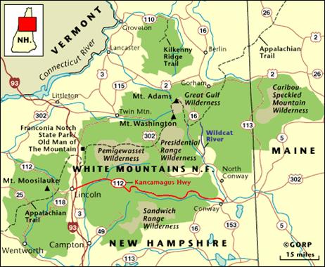
Mt Washington is the highest peak in the White Mountains with an elevation of 6288′. There is a weather station on its summit that publishes several forecasts used by hikers to plan winter trips to the peaks in the Presidential Range, including Mts. Washington, Adams, Jefferson, Monroe, Madison, Eisenhower, Pierce, and Jackson. Their weather forecasts have diminishing applicability the farther away you plan to hike from these mountains.
- Higher Summits Forecast: Good forecast of what to expect on Mt Washington, the northern Presidentials and Southern Presidentials, and other above-treeline trails, 4500′ or higher, throughout the White Mountains. I usually subtract about 10 mph off the Mt Washington wind speed to estimate what the wind speed on Mt Adams, Mt Monroe, or Mt Jefferson will be and subtract 15-20 mph to estimate the wind speed on Mt Lincoln and Mt Lafayette. I avoid hiking above-treeline peaks when the winds exceed 30 mph sustained (not gusts) in winter.
- Mt Washington Current Summit Conditions Dashboard: Good overview of the current conditions on Washington itself. I look at the wind direction and the wind speed, but the dashboard has limited forecasting value because it doesn’t predict future conditions.
Weather.Gov (Published by NOAA)
Weather.gov is published by NOAA, the government agency that oversees the National Weather Forecast. It publishes a ton of very useful weather and climate information and educational material. Most of the commercial weather forecasts in the US repackage and redisplay the information they provide. I prefer using their website because I figure it has the most complete and current information.
- Point Forecasts: Weather.gov provides a 7-day point forecasting capability that lets you zoom in on specific mountains or locations. For example, you can type in “Mt Bond, NH” into the Weather.gov search box to obtain a forecast. This is particularly useful for determining temperature and wind speed if the mountain you search is above treeline and exposed to the wind. This forecast is usually quite accurate.

- Hourly Weather Forecast: This is a sub-report located in the lower right-hand corner of Weather.gov’s 7-day forecast and is useful for predicting key weather metrics 48 hours into the future. The report lets you browse multiple variables including wind speed, gust speed, temperature, dewpoint, sky cover, thunder, and precipitation forecasts. It’s priceless for finding weather windows, where conditions are safe enough for a quick hike before they degrade.

New England Trail Conditions
NewEnglandTrail Conditions.com has a list of trail condition reports submitted by hikers that is invaluable for determining whether you need snowshoes or extra traction for winter hikes. It collates trip reports from several states but most of the trip reports found there are for the White Mountain National Forest in New Hampshire and Western Maine. These trip reports are also used to alert trail maintainers about trail hazards that require maintenance.

Most of the people who post trip reports here are very experienced hikers. Less experienced hikers tend to post their trip reports in Facebook groups, which can also provide useful information if you’re willing to scan through all the other drek that gets posted on them.

White Mountain 4000 Footer Forecasts
This is a single-page listing of all the forecasts available for all 48 the White Mountain 4000 footers that’s very convenient to access with a Smartphone. It includes all of the relevant forecasts and trail conditions reports for each mountain, including river gauge readings for those that require stream crossings. Click here to access.
Facebook Groups
There are several Facebook groups worth monitoring for trail condition information that’s not captured by New England Trail Conditions.
- The Randolph Mountain Club publishes a succinct weekly summary of trail conditions in the Northern Presidentials, including Mt Madison, Mt Adams, and Mt Jefferson. It’s compiled by the caretakers of the RMC’s winter camps so it’s quite accurate.
- The 4,000 Footer Club-Climbing and Hiking in New Hampshire has 55,000 members, who primarily climb the White Mountain 4000 footers. The same holds for Hike the 4000 footers of NH! which has over 90,000 members. The trails leading to the 4000-footers are almost always broken out and are therefore easier to hike in winter because they have the most traffic. The same can’t be said of other trails in the Whites. Unfortunately, a lot of the information shared in these groups is irrelevant for trip planning, but sometimes you get lucky.
Other Forcast Sources
- Mountain Forecast is another weather forecast that hikers refer to in the Whites because it has pictures to illustrate weather conditions. It tends to be optimistic when it comes to wind forecasts, often underestimating them by 10-20 mph. I ignore it and stick with weather.gov, but your mileage may vary.
Summary
There’s no single weather forecast that you can look up for weather conditions across all of the White Mountains. Local terrain, vegetation, and elevation can all have a huge impact on the weather conditions you experience in different regions of the mountains. As a winter hiker, you may need to piece together many different sources of information to determine whether more challenging routes are safe enough to hike or snowshoe or are best left for more favorable conditions. The ability to do so reliably comes with years of practice and a healthy respect for winter weather conditions.
 SectionHiker.com Backpacking Gear Reviews and FAQs


I find the Fairbanks Museum forecast to give a good overview of the White Mountain weather
Like you said, good overview, but doesn’t get into enough detail to forecast the microclimate conditions that exist for planning hikes. It is a good read though.
Such a well written article and synopsis on what influences weather. Thank you.
Thanks for this. I still use your White Mountains 4000 Footer Weather Forecasts links before every hike, any season. As always a great resource.
And just a side note but it seems like there are many hikers these days that don’t purchase the WMG book, relying only on internet trail description sites that in my opinion are not descriptive enough.
Plus the guide has so many wonderful historic tidbits
When they get more serious or fall in love with the Whites, they’ll buy the guidebook. But yes, sadly, the guide has been usurped by AllTrails even though its just plain awful in comparison.
This was a great article! We don’t have the weather in the Blue Ridge as you do in the Whites. But anytime you are in the mountains you have to respect the weather.
Excellent overview and listing sites that I had forgotten about. Also I now have a new site with the “White Mountain 4000 Footer Weather Forecasts”.