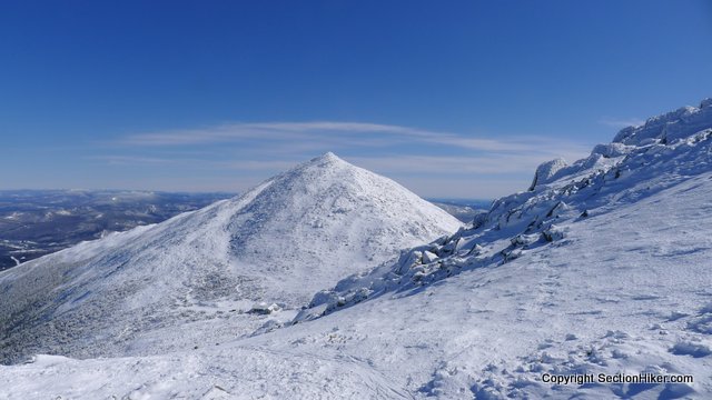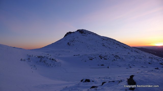
We made it to the Applachia trail head at the base of Mount Madison about 6 hours behind schedule on Friday night due to bad winter driving conditions on the road from Boston. Still, we decided we wanted to camp on the ridge that night instead of checking onto the Hiker’s Paradise in Gorham, so we headed up the Valley Way Trail to the col between Mount Madison and Mount John Quincy Adams.
While Valley Way is the ‘easiest’ trail up to the Madison Hut (closed in winter), it’s still a 3.8 mile climb with 3550 feet of elevation gain. Although we were carrying 45-55 pound packs with full winter gear, we made the climb in snowshoes in just 3:30, spurred no doubt by the unwelcome prospect of setting up camp in complete darkness above treeline.

This turned out to be unavoidable, but by the time we reached Madison Hut, the winds had died down for the night making it easy for us to pitch our tents, melt snow, and cook dinner. Still, we pitched out tents in the lee of the hut just in case the wind picked up again (from the north) during the night.
The next morning we woke up around 7 am , just as the first hikers and backcountry skiers started to arrive at the base of Mount Madison. We talked to them for a while while we ate breakfast and melted more drinking water and then packed up camp. One of the guys in our group wasn’t feeling well that morning, possibly due to dehydration, and was thinking about hiking out rather than hike the 15 mile Presidential Traverse. He really had a hard time deciding whether to continue and possibly force us down if he felt worse later in the day or to bail then. A tough call, he decided to quit and head back down.

That left Alex, Fred, and I as a group, which was still sufficient for the weekend weather forecast, which was for calm winds and warm temperatures. Each of us had a slightly different agenda for going on this hike – above and beyond the fun and challenge of completing it. Alex and Fred were mainly interested in practicing their above treeline camping with Fred’s new Hilleberg tent, a 3 person Nammatj, and Alex also wanted to bag Mount Eisenhower for his Grid. While I was hoping for a full Winter Presidential Traverse, I was mainly interested in bagging the Northern Presidentials (Madison, Adams, and Jefferson) for my winter 4000 list.

Despite these different agendas, the trip went quite smoothly, each of us making trade-offs and compromises to help one another satisfy their goals. For example, Fred and Alex, who’ve climbed Madison in winter before, let me run up and tag the peak before we headed south for the day. A few hours later Fred climbed Mount Adams with me, while Alex waited for us at Thunderstorm Junction, and then the three of us climbed Mount Jefferson together.

Although Madison, Adams, and Jefferson are all peaks on the same 5000′ ridge, hiking up each peak along the way takes a little bit more out of you. That first day, the climb up Jefferson really hammered me because I had to carry my full pack 700′ up and over it. On top of that, the afternoon sun had turned the snow beneath us into wet snow/slush, making snowshoeing that more challenging.

It was after 2:30 pm when we left the summit of Jefferson and headed toward the next peak in the range, Mt Washington. My window for climbing the peak in daylight was narrowing rapidly. We headed across the Monticello lawn on the southern face of Jefferson, past Sphinx Col and along the Gulfside trail on the east side of Mt Clay. When we came to the Cog Trestle, Alex gave me the option to hike up to the summit of Washington 1 mile / 1,000 feet and to meet him and Fred a few miles farther on near the Lakes of the Clouds hut where we planned to camp for the night.
I’d been pondering the decision for a few hours and decided against it, because I knew I’d be hiking down Washington alone in the dark, with no water left or cooking gas, both sub-optimal states of preparation in my view. I also know that parts of the Crawford Path from the summit of Washington to Lakes are hard to follow in winter, even in daylight, and the prospect of traversing this stretch by headlamp was unappealing to me. We continued on together.
It’s possible to bypass Washington if you’re hiking from Jefferson to the Southern Presidentials by following the Westside Path, built by the great trail maker J. Edmunds. This is a beautiful trail of boulders, miraculously fitted with the precision of a cobblestone road, and one of my favorite trails on Mt Washington. Not in winter though. Instead the trail was covered in hard wind slab and steep enough that a fall down its slope would have resulted in a fast descent of the Amonoosuc Ravine. We spaced ourselves out, in part to minimize avalanche risk, and walked this section with care.

By 4 pm, we came to the junction with the Crawdford Path and headed down toward the Lakes of the Clouds to camp above one of the alpine lakes or tarns located there. I found us some nice campsites with views of Mount Washington and Mount Monroe, but out of sight of hikers who would be climbing the two peaks the next morning.

After 7 miles of snowshoeing and climbing several high peaks, we retired quickly after melting more snow and eating dinner. I was pretty dead on my feet and ready for a warm sleep.
The next morning, we broke camp fairly late and headed south for another 8 miles to the AMC Highland Center in Crawdford Notch where I’d left my car. Though not as clear as Saturday, the temperatures were quite warm reaching 50 degrees when we were out of the wind.

From our campsite, we bushwhacked past the southern alpine tarn at Lakes, connecting up with the Crawford Path just below Mt Monroe. From here we followed the trail past South Monroe and Mount Franklin, with huge views into Oakes Gulf.

Next up was Mount Eisenhower, which we all climbed together. Named I assume, for Dwight Eisenhower’s bald head, Eisenhower is massive mountain with a gently sloped dome. The climb looked far worse than it was – thank god for televators – and we made it to the huge cairn on the summit with ease.
Past Eisenhower, we had a long picturesque ridge walk to Mount Pierce, before entering the trees again and the long walk down to Crawford Notch. As I sit here, exhuasted after another long day of hiking above treeline, I don’t think I’ll ever forget that Blue Bird Weekend in the Presidential Range.
 SectionHiker.com Backpacking Gear Reviews and FAQs
YEAH!
What a great trip report,. Looked very nice.
I must say, I’m really impressed with you guys walking this mountains
with snowshoes. I know it takes a lot of energy, and with full winter-backpack
and difficult snow-rock conditions (it looks like that atleast),
I can only say great job!
Most impressive!! Congratulations to all three of you for a successful traverse!!
You picked a fine weekend for it! Yvonne and I were on Okemo yesterday, and had the clearest view of Washington I think I’ve ever had from that far away. Sounds like this traverse is going to be one of the year’s highlights, if not of the entire 48 :-)
Words fail my ability to describe the beauty of this hike. Saturdays weather was so clear we could see the ski trails on mt Mansfield in Vermont. A magical trip.
WOW-WOW-WOW!
I had a hike on the Southern Presis on a bluebird day like this and the pics have been my computers wallpaper for about a year. Never forget that trip! Great report, hope your legs are functioning.
So, on campsite selection, does the 1/4 mi FPA get trumped by the Alpine Zone 2 feet of snow? The difficulty with planning a multi-day presi traverse is that the WMNF camping rules make it hard to find “legit” sites (not that I would expect a FS ranger to show up at midnight above treeline)
We made a conscious decision to camp near Madison Hut for safety reasons – there had been high winds that day (80+ mph) on Jefferson and we wanted the option to move our tents closer to the obstruction (the hut) if they picked up at night. We were extremely careful not to disrupt the area and were camping on top of plenty of snow so our impact, if any, was negligable. Obviously, you wouldn’t do this without 3 season snow cover. As for the ability to find legit winter sites – there are plenty above treeline – and our second night was spent at one of them. You need to go off trail though to find good protected sites.
Televators are the BOMB!!! I too will never forget my winter ascent of Washington yesterday. I can’t believe how lucky we all got with the weather this weekend. Great trip report and beautiful photos, Philip! Thanks for sharing.
Congratulations on the trip and on the fine weather, though it did get a little warm in the daytime. That happens.
The soccer game with the grandkids got rained out. I ended up taking a five mile bike ride on a paved trail with a whopping 50′ elevation gain–feel the burn! So, how does my weekend expedition compare with yours?
I lost my love handles and found my 6 pack in the mountains. I am trademarking this weightloss plan.
Late winter bluebird days make for memories that last a lifetime. Congrats on collecting this one.
It would be interesting and informative to have a post trip report about what was in your pack for this ambitious winter trip, the rationale for what was included and what was considered but excluded.
On my list to write. Probably later this week. I was lucky – I forgot a few things.
I passed by Madison Hut around 5 AM Saturday morning and saw your tents. One of you was snoring.
I hate sleeping on my back but my -25 degree bag requires it. Might have been me.
Well done.
Congratulations on a great accomplishment!! A winter traverse of the PR is one of our nation’s iconic mountaineering challenges. Well done, Sir.
We missed a couple of peaks – so it was really a Vice Presidential traverse. Still, I’m glad we completed the end to end hike.
In an interview I heard with a mountaineer a few years ago he said that the priorities should be (in this order)
1) come back alive
2) come back still friends
3) summit
Seems like you were adhering to the same guidelines.
Phil – nice meeting you on the traverse near T storm junction (had a feeling I’d bump into you). We ended up doing Adams and Madison, couldn’t have asked for a better day. Thanks again for the great site. I look forward to signing up for one of your hikes.
You got a fine trip in there pal. Wonderful and brings back memories. I like the safe thinking and not pushing risk levels.