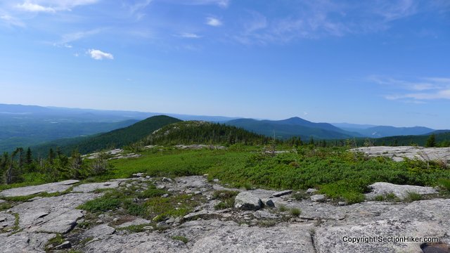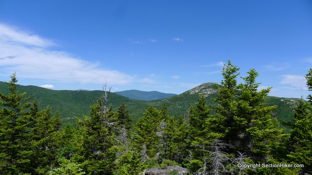
Eastman Mountain is a cone-shaped peak in Evans Notch located next to South Baldface Mountain but receives much less traffic than its more glamorous neighbor. It’s a worth destination however with good views of nearby Sable and Chandler Mountains and distant Cathedral Ledge and Mt Chocorua on a clear day.

The most direct route up to Eastman is via the Slippery Brook Trail from Rt 113, a gradual climb that also provides a much easier or alternative route up South Baldface when the Baldface Circle Trail’s ledges are wet. If you’ve never climbed South Baldface because those ledges are intimidating (and rightly so), the Slippery Brook Trail is a much easier way to climb the elevation needed to reach that peak.

On this hike, I climbed Eastman by first going up the Baldface Circle Trail, past the Baldface shelter and up the ledges because I wanted to visit Chandler Gorge and its many waterfalls and water slides along the way.

Rather than continuing to climb South Baldface, I hiked south along the Bald Knob Trail to what I assume is Bald Knob before crossing the Slippery Brook Trail and following the Eastman Mountain Trail to Eastman’s Summit. The Bald Knob Trail is largely above treeline and passes through an alpine zone before it descends down more ledges into a forested col.

The Eastman Mountain Trail is a quick 0.8 mile jaunt through open forest to a mostly open summit, which has excellent views of the back of South Baldface, Sable, and Chandler Mountains. From Eastman, I was very interested in looking at the col between South Baldface and Sable Mountain, which is a trail-less peak because hiking down the back of South Baldface is probably the most direct way to climb the peak. Sable and Chandler are on the NH 3000 footer list and Eastman is on the NH 200 highest list.

I could also see Cathedral Ledge from the summit of Eastman, and all the way to Mt Chocorua, 45 miles to the south. It was a nice, low humidity day and the views were fabulous!


From Eastman, I hiked down the Slippery Brook Trail to the point where it intersects the Baldface Circle Trail, about 1 mile up from Rt 113. Just before that, it crosses a stream which is the outflow of Chandler Gorge.

Here’s a break down of the mileage for this hike. I would not recommend reversing the direction because you don’t want to hike down the Baldface Circle Trail Ledges. No. No.
- Baldface Circle Trail to Chandler Gorge Loop (1.2 miles)
- Chandler Gorge Loop back to Baldface Circle Trail (0.5 mile)
- Baldface Circle Trail to Bald Knob Trail Junction (1.9 miles)
- Bald Knob Trail Junction to Slippery Brook Trail Junction (0.7 miles)
- Eastman Mountain Trail to summit and return (1.6 miles)
- Slippery Brook Trail Junction to Baldface Circle Trail (2.6 miles)
- Baldface Circle Trail to Rt 113 (o.9 miles)
Total Mileage: 9.4 miles w/ 3000′ feet of elevation gain
 SectionHiker.com Backpacking Gear Reviews and FAQs
I walked four levels of a parking garage the other day. I don’t think anyone wants to read my trip report…
You need to get out more.
Awesome pictures, the scenery is amazing. Can’t wait for the weather to cool off so I can get back out there. It’s been far too long since even my last day hike.. well since July 5th but who’s counting?
Please excuse my ignorance, but what does “col” stand for?
The small col between South Baldface (right) and the northern (right) shoulder of Sable Mountain
A col is the lowest point between two peaks on a mountain ridge. Also called a saddle.
Thank you. I know it as a saddle, just never heard of a col before :)