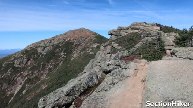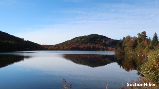
The two most popular peaks to climb on Franconia Ridge, are Mt Lafayette and Mt Lincoln, two 5000-footers with stellar views of Franconia Notch and the Pemigewasset Wilderness. These two mountains are sublime and magnificent in their own right, but they really come alive during the first two weeks in October, when the weather gets colder and the leaves begin to change color. The fall foliage peaks on October 10th, every year without fail, when the 800,000 acres of trees in the White Mountain National Forest turn yellow, gold, and red. It really is a sight.
Franconia Ridge has become a very popular destination, in part because it is so close to the interstate highway. So the trick is to hike it when it’s not completely overrun by visitors if that kind of thing matters to you. I knew that Lafayette and Lincoln wouldn’t be crowded on a Monday (Oct 3). So there I was at 9:00 am on a frosty Monday morning, parking my car at a little used trailhead, when most people are shooting the shit about their weekend on Zoom or at the office.

The last time I hiked Franconia Ridge (called “the ridge”) was in July, with my buddy Ken, when we hiked it in a complete white-out in blowing mist despite a sunny forecast. That happens, but it wasn’t particularly satisfying. This time, I wanted good weather because I wanted to celebrate a hiking milestone, the completion of my 8th round of White Mountain 4000 footers. That peak list includes 48 mountains, including many 4000-footers, a half dozen 5000-footers, and a 6000-footer – Mt Washington. Despite a chilly forecast with a morning frost warning, it sounded like it would be a clear day with low wind on the ridge.
I still packed a few layers, just in case the weather turned nasty or the wind picked up. We’re already in the fireplace/wood stove season in the Whites and, even though it seems like summer was just yesterday. I’ve started wearing long pants instead of shorts on my hikes and one of these days, I’m going to have to switch from trail runners to waterproof mids to keep my feet warm.

There are a couple of different ways to climb to Lafayette and Lincoln, some more popular than others. For this hike, I climbed to the ridge via the Skookumchuck Trail which is a relatively moderate climb but far less popular than the Falling Waters Trail. I first discovered the “Skook” way back when when I was section hiking the New Hampshire Appalachian Trail for the first time since the ridge in on the AT. The Skook reaches the ridge 0.8 miles north of Mt Lafayette. From there, it’s a short hike to the Lafayette summit and another mile south to Mt Lincoln.

The Skookumchuck Trail starts just north of Franconia Notch from a trailhead parking lot at the north end of the Franconia Bike Path, which runs for 8.8 miles up the middle of the notch (A notch in NH is another name for a mountain pass). While the Skook climbs 3000′ to the ridge, it’s not overly steep at any point and doesn’t require any scrambling, until the very very end, and even that’s not bad. It climbs through open forest most of the way, passing a lovely stream at 2500′ and spring at 3000′ of elevation where you can get water. It’s much easier than climbing the Falling Waters Trail, which requires at least three stream crossings, where you’re bound to get your shoes wet.

For this hike, I wanted to do a loop on trails I hadn’t hiked for a while. So after summiting Lafayette and hiking south to Mt Lincoln, I reversed course and hiked back up Lafayette. Once you’re up on the ridge, the incremental elevation gain between the peaks isn’t that significant. The hard work is getting up there.
From Lafayette, I headed down the Greenleaf Trail to the AMC hut which stays open until Oct 15, 2022. I refilled my water bottles there from the outdoor hiker faucet and then continued down the lower section of the Greenleaf Trail, which is seldom hiked, following it down to Franconia Notch. From there, I crossed under the interstate that runs through the notch and walked north along the Franconia Bike Trail for another 3 miles, looping back to the Skookumchuck Trailhead.
This was a 14-mile route with about 5000′ feet of elevation gain and I was pretty tired when I finished (in 8 hours.) Still, the extra distance was worth it because I only saw two people on the Skookumchuck and two people on the lower part of the Greenleaf Trail below the hut. The ridge also wasn’t very crowded and I only saw about 100 people up there in total, spread out over 2.8 miles. I can only guess what it’s like on a weekend, but I wouldn’t be surprised if 1000 people or more head up there, at least from the stories my friends tell me.

The foliage was lovely, although not as far along as I would have expected in the Pemigewasset Wilderness, compared to the eastern side of the forest near Mt Washington, where the reds are much more evident. The sky was very clear and the mountains in Vermont were also clearly visible on the far horizon. There was no wind and I only had to wear a fleece hoody to stay warm.

The views of the peaks in the Pemigewasset were spectacular including Garfield, Guyot, Bondcliff, and Carrigain, and Jefferson and Washington, farther east. While I’ve climbed all of them many times, it’s still a pleasure to look at their profiles in the distance. I’m more spiritual than religious, but you can’t help wondering how something so beautiful was created by accident and not on purpose.
 SectionHiker.com Backpacking Gear Reviews and FAQs
Wow, congratulations on your 8th round of the 4000 footers! Hell of an accomplishment!!
Hi Philip. My son (23) & I (58) are planning to hike AT in NH next Aug or Sept. Both I of us are great shape – fitness won’t be a problem. I just need some help with planning & logistics. We’d like to spend a nite or two in one of the AT Huts & another night in a local motel, B&B, etc…. Can you recommend a website or resource that can help me with some planning?
Outdoors.org (the AMC) or The AT Guide.