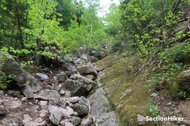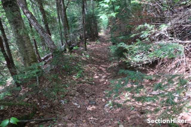
North Tripyramid is a 4000 footer located in Waterville Valley, NH, in the southern half of the White Mountain National Forest. While there are a number of different trails you can follow to climb it, the most challenging one is via the Mt Tripyramid Trail, which climbs an avalanche slide on the mountain’s northwest face gaining 1,200 feet of elevation in 0.5 miles.
While parts of the slide are loose gravel and sand, most of it consists of large rock slabs that are relatively easy to climb provided they’re dry, snow, and ice-free. You still need to be careful with your hand and foot placements while climbing them, wear appropriate clothing and shoes for rock scrambling, and pace yourself for the long and steep climb. The best time to climb the slide is from mid-June to October, although snow and ice can linger into June. Climbing down the avalanche slide trail is not recommended.
Hike Description
- Difficulty: Strenuous
- Distance: 11 miles
- Elevation Gain” 3000 feet
- Water: Bring at least 2 liters per person. Natural water sources are available but filtering is recommended.
- Trailhead Directions: Livermore Road Trailhead. GPS (43.965743, -71.513628). Follow Rt 49 from I93 and turn left after 10.5 miles onto Tripoli Rd. Bear right past the entrance to the Waterville Valley Ski area and look for the Livermore Trailhead parking signs on your right. The parking is quite large and has bathrooms, which are closed during the pandemic. There is usually a White Mountain National Forest parking fee, although not during the Pandemic.
- Blazing: The Mt Tripyramid Trail is blazed yellow. However, blazes painted on rocks can be faint and hard to see. The best way to climb the route is to stay to the left or middle. Portions of the right side are covered with moss and slippery.
- Recommended Maps and Guidebooks:
- Season: mid June through October. Avoid the avalanche slide when wet or icy. May and June are bug season, so bug dope and head nets are advised.
- Camping: White Mountain National Forest Backcountry Camping Regulations
- Wilderness Area Regulations: Portions of the Mt Tripyramid Trail, the Pine Bend Trail, and the Scaur Trail are located in the Sandwich Range Wilderness Areas. Group size is limited to 10 people. Please obey all Wilderness Area regulations.

Trails
This hike is an out-and-back lollipop loop to the summit of North Tripyramid Mountain. All of the trails are well signed and easily followed. The total distance of this hike is 11 miles with close to 3000 feet of elevation gain.
- Livermore Trail – 3.6 miles
- Mt Tripyramid Trail – 1.2 miles
- Pine Bend Brook Trail 0.8 miles
- Scaur Trail -1.2 miles
- Livermore Trail – 3.8 miles

If you suspect that the slide will be too difficult or scary for you to climb, I’d encourage you to decide early and hike to the top of the slide via the Scaur Trail and the Pine Bend Brook Trails. The Scaur Trail leaves the Livermore Trail 0.2 miles after the Tripyramid Trail to climb the avalanche slide. From the Scaur Trail, turn right onto the Pine Bend Brook Trail and follow it 0.8 miles to the North Tripyramid summit. This way, if your party continues to climb the slide, you can still meet them at the North Tripyramid summit and hike back together.
If you want to continue to Middle and South Tripyramid after climbing to North Tripyramid, see the following trip plan: Mt Tripyramid Loop w/ the North and South Slides.
On the Trail

Leave the southside of the Livermore Trailhead parking lot and make a left onto the Livermore Trail. This is a wide gravel road and is easily followed. Continue along it for 3.6 miles until you reach the second Mount Tripyramid Trail Junction, the one leading to the “North Peak.”

Continue to the next Mt Tripyramid Sign shown below. Descend several rocks stairs and cross Avalanche Brook, which is a very easy, rock hoppable, stream crossing. Continue up the other embankment and follow the yellow-blazed trail, for 0.5 miles, passing the Sandwich Range Wilderness Area sign.

The base of the avalanche slide begins at a yellow sign that reads “Mt Tripyramid Trail. From here the trail ascents 1200′ in 0.5 miles, making it one of the steepest trails in the White Mountain National Forest.

The bottom of the slide is just a jumble of rocks, but it quickly turns into a series of slabs.

If you use trekking poles, this is a good time to tuck them away since you’ll need both hands to climb the slabs. The handholds and footholds are actually quite good as long as the rocks are dry.

The hardest part of the ascent is actually the beginning where the “trail” is quite narrow. Higher up, it widens quite noticeably and becomes easier to walk up, provided you have sticky rubber soles.

If during the slide ascent, you find the exposure too intimidating, an unofficial and unmaintained bypass route has formed along the left-hand side of the slide but does not extend to the top of the slide. I’m not encouraging you to take that route but it is there if you need to get off the main trail out and take a time out. Reversing your route and backtracking down the slide is not recommended. That is much more difficult and hazardous.

As you climb higher, you’ll encounter areas of loose gravel and small stones, which may shift underfoot. You’ll find that walking on the solid rock slabs is much more secure and far less dynamic.

The top of the slide is marked by a large rock cairn which marks the entrance to a side trail on your left and reenters the woods for 0.1 miles in the final climb to the North Tripyramid summit which is largely viewless.

From the summit, follow the Pine Bend Brook Trail back in the direction you came from but bearing right at the trip sign, toward the Scaur Trail (pronounced “Scour”). Follow it for 0.8 miles to and turn onto the Scaur Trail, where you can catch glimpses of North Tripyramid through the trees.

The Scaur Trail is quite pretty and very easy to follow. It ends when it meets the Livermore Trail in 1.2 miles where you’ll turn left. From here, follow the Livermore Trail 3.8 miles back to the Livermore Trailhead parking lot, retracing your earlier steps.
SectionHiker is reader-supported. We only make money if you purchase a product through our affiliate links. Help us continue to test and write unsponsored and independent gear reviews, beginner FAQs, and free hiking guides. SectionHiker.com Backpacking Gear Reviews and FAQs
Would this serve as a good training hike for Huntington Ravine? Huntington is at the top of my list, but I want to build some confidence and experience on a similar trail first.
Yeah. But pretty much anything in the Great Gulf would too. This is actually much harder than Huntington and much longer.
Wow, really!! ???
I thought Huntington was the hardest and scariest?
I’ve done this and the loose headeall on Great Gulf Trail
Hi Phil,
I did this hike last month and it was a rough hike up the slide. The terrain has changed dramatically over the years according to my hiking companion on our hike. Now I’m ready to do a comparison hike and hike the Huntington Ravine Trail.