Sugarloaf Mountain is a 52-with-a-view peak in the Nash Stream Forest, a conservation area in Northern New Hampshire, about 10 miles north of Mt Cabot and the northernmost border of the White Mountain National Forest. The Nash Stream Forest is considerably less developed than the White Mountains to the south, although there is a well signed and blazed trail system. All of the roads leading to the area’s trailheads are unpaved however and you’ll want to bring a car or truck with some extra clearance and wider tires to handle the roads. Cell phone service is also negligible, so you need to be self-sufficient.
Sugarloaf is a popular peak to hike because it has stunning views of the north country forest and mountains. On a clear day, you can even see the Northern Presidential and Franconia Ridgelines far to the south in the White Mountains. There are several other Sugarloaf Mountains in the White Mountains and New Hampshire Area, so make sure that this is the Sugarloaf that you’re looking for. There is also a trailless Sugarloaf Mountain in the Benton Range near Mt Moosilauke and the North and Middle Sugarloaf peaklets, located off Zealand Rd near Twin Mountain, NH.

Hike Description
- Difficulty: Moderate
- Distance: 2.1 miles to the summit of Sugarloaf Mountain. 4.2 miles round trip.
- Elevation Gain; 2200 feet
- Water: Bring at 1-2 liters per person. Natural water sources are available but filtering is recommended.
- Sugarloaf Mountain Trailhead Directions: (GPS: 44.736214, -71.438768) From Rt 110 cross the Stark, NH covered bridge and follow Northside Rd for 3.5 miles. Continue straight (north) onto Nash Stream Rd for 8.2 miles. The trailhead will be on your left. Park along the right side of the road just before the bridge. There’s space for a half dozen cars parked head in.
- Blazing: The trail isn’t blazed, but the footpath is obvious and signed.
- Recommended Maps and Guidebooks:
- Season: June-November. The main road in Nash Stream Forest is gated closed in winter and usually opens in late May. June is bug season, so bug dope and head nets are advised.
- Camping: The Cohos Trail, a 170-mile long-distance trail, runs through the Nash Stream Forest it is requested that backpackers and campers use the designated shelters and tent platforms available on the Cohos Trail. Those are the only locations where camping is permitted.
On the Trail
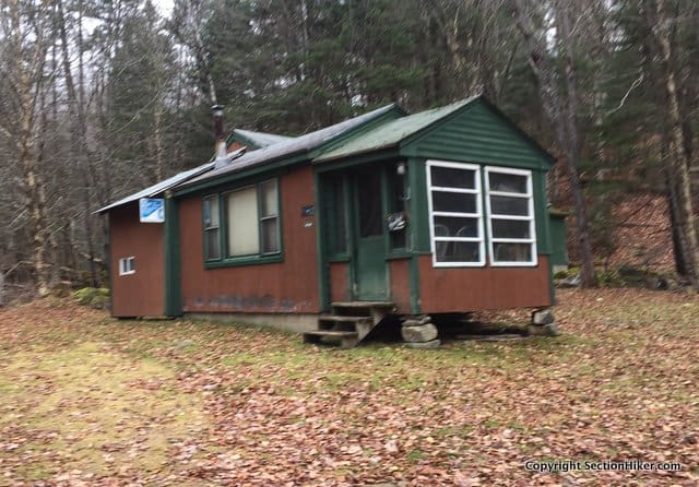
The bottom of the Sugarloaf Mountain Trail runs past a cabin, what people around these parts call camps. Pass by it on the left, cross a wooden snowmobile bridge, and walk around a metal gate.

You’ll soon come to a signed fork soon that has bright yellow arrows pointing left. Those are for snowmobiles, not hikers, so ignore them and keep going straight. Pass a sign for the Sugarloaf Mountain Trail on the left and climb, relentlessly up the trail which gains 2200 ft of elevation in 2.1 miles. The footpath is an old jeep road that provided access to fire warden’s camp and fire tower at the top of the mountain, so it’s quite wide and easy to follow.

At 1.6 miles. you’ll come to a clearing with the remains of the firewarden’s camp, including an old rusty sink on your right. There’s a short path to the left which leads to a muddy spring, so continue right to climb up to the mountain’s summit ledge. There, you’ll find the summit sign and beyond it a viewpoint with an expansive view.

If you’re very familiar with the White Mountain skyline, it can be a bit of a shock to realize that you can’t name any of the peaks from the summit of Sugarloaf Mountain. There are a lot of mountains in New Hampshire and climbing Sugarloaf Mountain is an excellent place to expand your horizons beyond the 4000 footers to the south.
SectionHiker is reader-supported. We only make money if you purchase a product through our affiliate links. Help us continue to test and write unsponsored and independent gear reviews, beginner FAQs, and free hiking guides. SectionHiker.com Backpacking Gear Reviews and FAQs
I loved this hike.
But seriously, what’s with all the Sugarloaves? :-D
My guess is that the somewhat rounded, symmetrical shape of a sugarloaf (see picture in the Wikipedia entry) is a rare enough shape for a mountain that it stands out in any one area, while it is common enough that we find them all over — at least all over New England. Fair warning: this is based on no actual research; it is just what I have assumed for decades of living and hiking here.