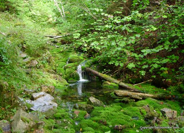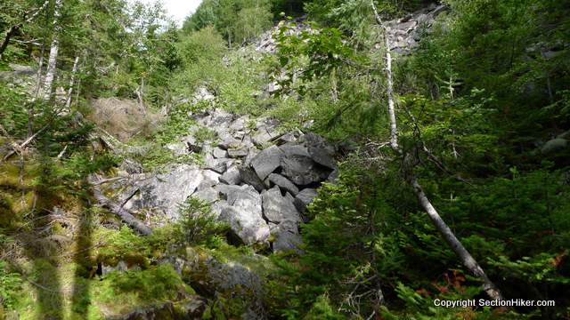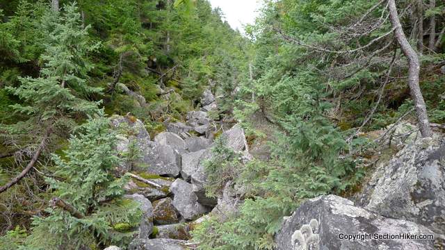
Ice Gulch is a narrow, boulder-filled ravine in the Randolph Community Forest on the north end of the White Mountain National Forest region. It’s so-named because you can find snow and between the rocks there in August and it’s quite similar in that respect to Mahoosuc Notch (the hardest mile on the Appalachian Trail) a short way to the north.
While there is technically a “trail” running through Ice Gulch, it’s more of a rocky scramble, 0.9 miles in length. It’s a strenuous scramble at that, and it took me 1:45 to cover that short distance. While the White Mountain Guide lists Ice Gulch as one of the most strenuous trails in the White Mountains, I think that’s a bit of an exaggeration. Nevertheless, this isn’t an easy hike and one you definitely don’t want to bring dogs or small children on. It’s just too sketchy and slippery in places.
Here’s a description of the loop hike, starting on the Ice Gulch Path, taking the Peboamauk Loop around a pretty waterfall en route to Ice Gulch, ascending (climbing up) the Gulch, and looping back along the Cook Path back to Randolph Hill Road, where a short road walk is required to hike back to your car.
When you go, be sure to bring some extra insulation along. The Gulch can be 15-20 degrees cooler than the surrounding forest, even in August, and you’ll want an extra layer or two to stay warm.


Total Distance: 6 miles with 1500′ of Elevation Gain

 SectionHiker.com Backpacking Gear Reviews and FAQs
The only place I find year round ice in the Dallas area is in my freezer. It’s not nearly as pretty… unless I’m REALLY hungry!
This was a neat hike. I was sore for days afterwards. I had to use my upper body muscles a lot more than usual for the scramble.
May be easier on snowshoes when its filled in?
Hard to say. I’d really hate to slip there in winter and get trapped between the rocks. It’s entirely conceivable.
I love hikes with rock scrambles. Can’t believe there is still snow and ice there in August. Wow. Thanks for sharing this trip with us.
wow. That gorge is certainly steep and deep. Checking it out on the aerial photog on Google Earth, the thing casts a shadow.
I don’t even know if anyone will see this, but I wanted to say that when I was a kid my dad would take me on ‘walks’. One of those walks, when I was nine, was Icy Gulch. I have wanted to go back ever since, but I haven’t made it yet. My kids are teenagers and FINALLY want to go hiking with me, but we are going to do a few easier hikes first.
I keep trying to describe this hike to people and can’t do it justice. Hopefully I will do it again and take some pictures. None of the ones from 1978 are very clear.
I saw it.
I had to turn back cause I did not want to bushwack in the Ice Gulch…trail needs maintainance
My son and I did this hike yesterday. I was looking for a nice gentle walk in the woods for the first hike of the season and after looking at the Trails Illustrated map and looking at the rating of “Moderate” decided this was it. Geesch… Topography and moderate do not describe this hike. We made it, though it took almost 6 hours.
Trails Illustrated maps…don’t get me started. Buy the White Mountain Guide and the Appalachian Mountain Club maps if you plan to hike in the White Mountains. Ice Gulch, as you found out, is a strenuous hike.
Daughter and I did the Ice Gulch loop trail and I will tell you, it needs some significant maintenance. The Cook Trail and the north end of the Ice Gulch trail both have a LOT of blowdowns and we are talking 60′ long Pines that make it very difficult to get around. This is a strenuous hike. The .9 miles of the gulch took us almost 2 hours and navigating the blowdowns contributed to nearly an extra quarter hour. Lots of ways to get hurt there so no kids and give taking the dog a second thought. Snow and ice was there June 9th and some it made it more difficult than otherwise might have been. Seems like there was a blowdown on the Cook trail every 100′!
I wouldnt take a dog there in perfect trail conditions!
I hiked this yesterday with a friend. I’ve wanted to do it for years, but wouldn’t do it alone as it has too many ways to get injured from my research. It was a fabulous rock scramble my favorite ever. It took us 4-1/2 hours to complete. Neighbors and friends did it today with their two boys. They said it was the toughest hike they have done a a family.
Definitely a tough hike.
Understatement of the ages! We went yesterday. 4’11” will always take twice as long as everyone else. I did have to get very creative with some of those boulders.
Glad you made it out!