Mt Monroe is the fourth highest four thousand footer in the White Mountain National Forest, while Mt Washington is the tallest, #1. They’re often hiked on the same day because they’re adjacent to one another in the middle of the Presidential Range and both are located on the Crawford Path, which is one of the main trails leading to Mt Washington.
This being April, we knew trail conditions would be mixed with some ice, some snow, and bare rock but we were unprepared for the amount of slush and water draining running down the sides of Washington when we climbed to the summit. It felt like the mountain was melting beneath my feet! But I’m getting ahead of myself.

The forecast for this hike called for temperatures to be in the low forties Fahrenheit and partly sunny with winds of 20-25 mph gusting to 35 mph, which is pretty mild for Mt Washington at this time of year. Nearby Mt Monroe is about 1000 feet shorter, so we expected it to be even milder. There weren’t any recent trip reports on NewEnglandTrailConditions.com but we figured we’d try Hillsound Trail Crampons and bring along full crampons in case we needed more traction on the descent. I was accompanied by my regular peakbagging partners Ken and Karen who are trustworthy companions with loads of four-season experience in the Whites.

We started this hike from the hiker lot below the Cog railway station, which shaves about 2 miles off the route than if you start at the Forest Service Amonoosuc Trailhead Parking Lot. We chatted with a few backcountry skiers who planned to hike up Washington and ski in Airline Gully (never heard that name before) in the Great Gulf. While I think they’re all batshit crazy, you have to admire the fitness and skill level required to climb Mt Washington with skis and ski boots attached to your backpack, let alone climbing back up the Great Gulf headwall a few times to get in multiple runs.
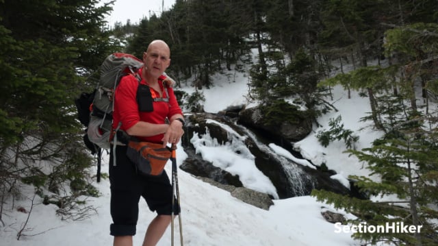
We headed up the Amonoosuc Trail which was covered in slushy snow and soft ice, bare booting at first, but we soon switched to Trail Crampons, which are microspikes with very long sharp spikes. This trail climbs very steeply to the Lake of the Clouds Hut at the foot of Mt Monroe, but that climb, 2500′ in 3.1 miles, would be the hardest part of the day.

However, we were soon sweating buckets because it was much warmer out than expected. Ken and I stripped down to our baselayer shirts, removed our hats and gaiters, and rolled up our pants legs to cool off. I’d neglected to bring a brimmed hat and knew I’d have to keep my wool cap on all day to prevent sunburn on my head above treeline. I had brought suntan lotion though, so at least my face and ears would be spared.
When we arrived at the Hut, we dropped our packs and climbed to the summit of Mt Monroe, which only requires an additional 350′ of ascent. There were a few steep parts made tricky by ice, but the climb was pretty straightforward, although the descent took some caution to prevent a long slide down the east face.

Back at the hut, we sat on the warm rocks below the “lakes” which are the glacial tarns after which the hut is named. The doors and windows were still boarded for winter and the front of the hut was buried in snow up to the roof. I chugged a quart of hot tea and ate a sandwich loaded with honey to keep my energy up for the climb up Washington.
We set off on the Crawford Path toward Mt Washington and quickly encountered water streaming down the slush that covered the trail. We were all wearing waterproof insulated boots so our feet stayed warm, but the slush was so deep there were a few times I was worried that the water would top my boots.

The Crawford Path is normally easy to follow with all the rock work that has been done to it over the years. It is the oldest continuously maintained trail in the United States, first cut in 1819. But the scree walls and carefully fitted rock steps that form the trail were hard to pick out amidst the slush and lingering snow before us. We’ve all hiked up here enough that we knew where the trail was supposed to be and we did our best to head in the right direction.
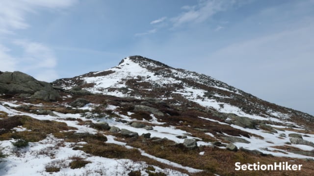
The distance between the hut and the summit of Washington is 1.3 miles and about 1100′ of elevation gain, completely exposed to the weather, which can be quite severe at times. As we climbed, we crossed one of the remaining snowfields on the peak, cautious to avoid an uncontrolled slide down into Amonoosuc Ravine. I’d thought about bringing an ice axe on this hike and knew I would have felt better here with it in hand.

Once we’d passed that obstacle, we continued picking our way through the slush trying to avoid full submersion, climbing past the Davis Trail and Westside Trail junctions toward the summit. When we finally made it to the summit sign, we marveled at the warm temperatures. It had reached 65 degrees, warmer than Boston, some 150 miles to the south.
The summit of Washington is an odd place. There’s a weather station up top, and we always refer to their forecast when climbing Washington and the other Northern Presidential peaks, Adams, Jefferson, and Madison. There are several buildings on top, including a restaurant, a post office, a gift shop, scientific offices, and living quarters for the forecasting/summit crew. The restaurant, post office, and gift shop are all closed in winter, as is the Mt Washington Auto Road which charges a fee for cars and motorcycles to drive to the top and sightsee during the warmer months.

As we stood there we discussed our descent. Ken and Karen wanted to hike down “the Cog”, which is a tourist train that takes people up and down the mountain. I was hesitant because I had no idea what the road would be like and whether it was safe to hike down it given the current snow conditions. They assured me it would be fine – since they’d hiked down a few months earlier for the first time too.

The “Cog” road is a popular route with peakbaggers, especially gridiots, because it shortens the hike up and down Washington by several miles. It does that, but it is a hideously ugly way to climb or descend the mountain, which can really snuff your mood. There’s an elevated track that runs up the side of Washington, but the ground adjacent to it is littered with pieces of coal, rotting wood timbers, old rusting rails, wire, bolts, and all kinds of industrial garbage. It’s kind of surreal given that it’s surrounded by one of the most majestic and heavily protected mountain ranges in North America. I tell people, “Mt Washington died so the rest of the National Forest could be saved.”

The Cog road turned up to be easier and safer than I expected although it was still very slippery with slush, wet snow, mud, and a few precipitous drops if you lost your footing. But it was a fast exit that did save more than an hour if we’d come down the Jewell Trail instead. It wouldn’t be my preference, but it’s a good option to know about if you have to get off Washington fast.

 SectionHiker.com Backpacking Gear Reviews and FAQs
Great post as always. I’ve done the cog path a few times as I typically hike solo and its the safest route up or down for winter IMHO. Which brings me to my point. I’m sure you’re familiar with Pam Bales and “John”. Have you ever had the opportunity to speak with her? In the descriptions I’ve read of the rescue it sounds like she was very close to the cog and I’m curious as to why she didn’t descend there. It seems that would have been the easiest quickest route down instead of heading back to the Jewel trail. Your thoughts and insight are appreciated.
Never spoken to her – no idea what she was thinking.
I ran into Ken and Karen this Saturday on the Hancocks and we discussed this as well. Ken and Karen, if you read this it was nice meeting you both
They both rave about that movie – said it sucked.
They expressed that to me as well
Enjoyed sharing your journey! Still a lot of snow here (PNW) and cold in Mtns, but expect similar conditions in a month or less. Bears just now waking up. We have been using micro-spikes for decades (first time we saw them thought they would not work well, but soon changed our minds), but will try the Hillsound’s based on this.
I did Monroe & Washington a couple of weeks ago, and the Cog was my bailout if things got hairy. It was very windy and the hike over to the Jewell Trail wasn’t easy, with the wind and ice and boulders, but the Jewell was ok other than a few blow-downs. Spikes the entire way down. Great article as always, Philip.
Great post! Love the site – always great content, very informative. I’m a relatively new hiker and I want to try Washington later this summer, but always fascinated by people who do the Presi’s in winter. Regarding Bill’s comment – is it possible that Pam Bales, with a hypothermic rescuee in the midst of a storm, felt the cover below treeline was preferable to an exposed route the whole way down, even if it was longer? Having limited knowledge, I’m just curious.
Possibly.
It is actually easier to hike up Washington directly rather than the route described here. This is not the best way to do it.
Not if you want to summit Monroe on the same hike. You really don’t want to come down the Ammonoosuc Trail when its very slick with ice and sush.
Fair enough. I just don’t agree with the route mentioned here. It just adds unnecessary time and effort to the trip. I wish you would be more clear about this.
Why? It’s my trip report. There are many ways to get up to these two peaks and they vary in difficulty, danger, and beauty by the time of year and trail conditions. It must shock you that some of us appreciate hiking all the trails, in addition to bagging the peaks. If you only take the shortest fastest route….you don’t know what you’re missing.
I guess to each his own. I just don’t agree at all with the route you are suggesting here. It is needlessly long and less exciting anyway than going straight up.
I guess if you like hiking through an industrial waste junkyard!
I’ve known Philip a long time and he’s much more interested in the aesthetic experience of hiking beautiful trails than speed. His route makes perfect sense to me. The guy has hiked every trail in the Whites twice. He should know the best routes!
Isn’t that one of the points of hiking? “To each their own” or “Hike your own hike”. I can think of many routes where the most enjoyable path (to me!) is neither the shortest nor the fastest.