Water is heavy and the last thing you want to do if you are climbing a peak in New Hampshire’s Northern Presidential Range or doing a Presidential Traverse is to carry extra drinking water. As it turns out, there are several spring-fed, above-treeline water sources that you can resupply water from during your hike if you are hiking in the off-season or after hours when the Appalachian Mountain Club Huts or the Mt Washington Cafeteria are closed.
All of the following springs are located on or just off the Gulfside Trail which starts between Mount Madison and Mount Adams and runs south to the Crawford Path on Mount Washington. This is the main hiking trail over the Northern Presidentials linking Mounts Madison, Adams, Jefferson, Clay, and Washington. I collected the GPS coordinates for these springs last July on an epic 2 night backpacking trip I took through the Great Gulf, climbing up the Mt Washington headwall and then hiking back to my car by looping back over Mounts Jefferson, Adams, and Madison and down the Osgood Trail.
Water Sources From North to South:
Peabody Spring: 44.31742 N, 71.30264 W

The Peabody Spring is located along the edge of the Gulfside trail in a section of trail bordered by krummholz, just south of the Israel Ridge trail junction. Looks for a puddle beneath a large trailside boulder on the Great Gulf side of the trail. If you’ve hiked the Gulfside Trail before, chances are you’ve walked past this boulder many times.
Spaulding Spring: 44.31173 N, 71.31286 W

The Spaulding Spring is located about 25 yards down the Cornice Trail from its 3-way junction with the Castle Ravine Trail and Randolph Path. Look for a small rock, painted red, on top of a collection of other small boulders to your left, which marks the location of the spring.
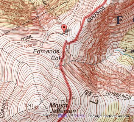
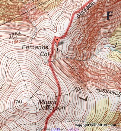
Gulfside Spring: 44.30999 N, 71.31226 W

The Gulfside Spring is a good flowing water source, just down from the Edmunds Col Cut Off Trail. This is one of the easier springs to find.
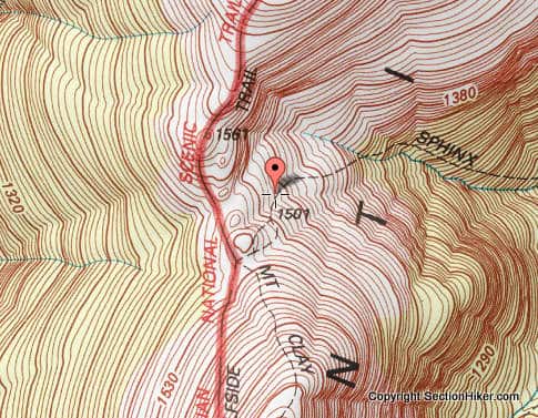
Sphinx Trail Spring: 44.29336 N, 71.31556 W

The Sphinx Spring is located in a small boulder field a short way down from the upper part of the Sphinx trail. Look for a small cairn atop a large boulder. If the cairn isn’t there, look for a puddle under a large boulder and listen for the sound of trickling water. You will need some sort of scoop or a small plastic bag to reach between the rocks to collect water.

Greenough Spring; 44.28919 N, 71.31794 W

The Greenough Spring (see top photo) is about 0.2 miles south of the intersection of the Gulfside Trail and Clay Loop Tr. Look for a sign along the trail that marks the spring and follow a faint path through the krummholz to it. The water is easy to see between the rocks although a scoop of some sort is useful to collect it.
Water Treatment
Given the amount of human and dog traffic that passes along the Gulfside Trail, I’d recommend that you use some form of water treatment for the water sources that lie very close to the Gulf Side Trail such as Peabody Spring. This water source is situated in such a way that it can collect run-off tainted by human or animal excrement and treatment and using a water purifier or Aquamira drops is advisable.
See Also:
- Aquamira Water Purification Drops Review
- MSR Guardian Water Purifier Review
- Grayl Geopess Water Purifier Review
- RapidPure Intruder Water Purifier Review
 SectionHiker.com Backpacking Gear Reviews and FAQs
How reliable are these sources? Enough to plan a trip around?
Very reliable…they are springs that are unaffected by rainfall and keep pumping water to the surface. Incidentally, I collected these locations for AMC Publishing to be included in the revised forthcoming edition of AMC’s Best Backpacking in New England by Matt Heid. Damn fine guidebook. Probably the best I’ve ever read.
For laughs you could include Dr.Ball’s rain water rock on Ball’s Craig. Not reliable but classic
All but one of the springs (Sphinx Trail) appear on the AMC’s White Mountains Trail Map #1 as well, and in the White Mountain Guide, 30th Ed. I don’t know about previous versions.
if they only read maps or carried them…
In your experience, is a smart device with online maps/GPS capability a sufficient substitute for a printed map on the essentials list? I’d be worried about losing signal and/or power.
No. GPS Apps Lie in several different ways. I ALWAYS CARRY a map and a compass to double-check anything I read off a GPS app.
I’m in the process of writing an article about all the different ways a GPS smartphone app can “fail” to provide accurate information.
It’s always best to have several ways to confirm a navigational judgment and not rely on just one.
Out west, people joke about getting water out of cattle hoof prints.
Is it safe to collect and purify, with a sawer filter , the pools of water located around the Lakes of the cloud hut?
That’s a good question. Given the number of people who will be passing by them this summer, now that the huts are closed by the pandemic, I wouldn’t drink from them even with a sawyer (water filter). They’ll probably only be safe is you use a purifier, which removes viruses like the Grayl Geopress, MSR Guardian, or Rapidpure Purifiers. They do get rather condensed because they’re in open sunlight, so you still might clog those purifiers pretty fast with silt and other muck (frogs live in the ponds), not to mention DOG traffic. My preference would be to go “down” as in dropping elevation to get running water and carry extra above treeline.
Again, given the human and dog traffic. I won’t be using the springs listed in this article. The hordes will undoubtedly fuck them up.
Thankfully, the AMC is still offering potable water at its huts, even if they’re closed for overnights. So, no need to filter water near Lake of Clouds this Summer.
As of July 1. Of course, if you have to go inside to get it, I’ll still probably carry extra. Lots of people still don’t wear masks in NH. My 2 cents,
Would these springs be accessible in April/winter or would they be frozen over still?
They’ll still be under about 3-4 feet of snow. Try late May or early June.
Hello,
I visited Mt. Washington last week and was intrigued to find Greenough Spring on the map. I’m curious if you know the origin of the name, as I enjoy family history. Thank you,
Katherine Greenough
No sorry.