 SectionHiker.com Backpacking Gear Reviews and FAQs
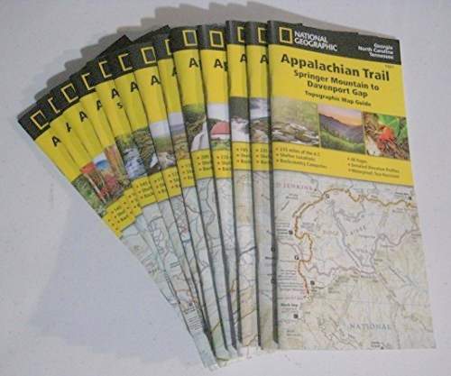
National Geographic publishes a thirteen map Appalachian Trail Illustrated map set of waterproof paper maps that cover the length of the Appalachian Trail from Springer Mountain, Georgia to Maine’s Mt Katahdin.
Available as a complete set or in separate 200-250 mile sections of trail ($14.95 each), they’re cleverly packaged in booklet form instead of huge fold out maps, a format that is more compact and far easier to manage than the large waterproof maps published by the Appalachian Trail Conservancy (ATC).
Here’s a list of the available trail sections:
- Springer Mountain to Davenport Gap (Map #1501)
- Davenport Gap to Damascus (Map #1502)
- Damascus to Bailey Gap (Map #1503)
- Bailey Gap to Calf Mountain (Map #1504)
- Calf Mountain to Raven Rock (Map #1505)
- Raven Rock to Swatara Gap (Map #1506)
- Swatara Gap to Delaware Water Gap (Map #1507)
- Delaware Water Gap to Schaghticoke Mountain (Map #1508)
- Schaghticoke Mountain to East Mountain (Map #1509)
- East Mountain to Hanover (Map #1510)
- Hanover to Mount Carlo (Map #1511)
- Mount Carlo to Pleasant Pond (Map #1512)
- Pleasant Pond to Mount Katahdin (Map #1513)
Each map booklet also contain a list of official campsites and shelters for that section, emergency phone numbers, an elevation profile, and educational content about Leave No Trace. Hikers intent on saving weight can pull the booklets, which are bound with staples, apart and just carry the maps without the other information if they prefer.
The maps themselves are overview quality, drawn on a 1:63,360 scale where 1 inch = 1 mile, with a superimposed UTM grid, easy to read sub-segment mileage between all road crossings, and include trail junctions, the location of springs, and points of interest. Many side trails and roads are shown on the maps, which are good for day hikers and section hikers looking to get on the trail and off at different locations.
The map data in the National Geographic maps is based on GIS route information provided by the Appalachian Trail Conservancy (ATC), in addition to other online sources and guidebooks.
If you’re an ATC member, you can get a discount on the National Geographic maps in their online store, which are listed side by side with the maps and guidebooks of the Appalachian Trail that the ATC publishes with the regional clubs that maintain the trail. While the ATC doesn’t have any plans to stop making and selling the maps and guidebooks they currently publish, it wouldn’t surprise me if National Geographic’s map sales soon eclipsed them because they’re more condensed, up to date, and easier to use.
Disclosure: National Geographic provided Philip Werner with an Appalachian Trail map set for this review.
Yeah, but is it really any good. Heard so many bad things about previous map collections that they are worse than useless as they are misleading and rather idiotic. Have you reviewed them for accuracy?
Yes – checking their accuracy was the first thing I did. I think the bigger question is whether its enough to carry a map on the AT when so much of the trail experience is off-trail (or which sections you want a map and which sections you don’t really need one because the trail is so heavily walked and well blazed). I always recommend that people carry the AT Guide pages corresponding to the section they’re carrying since it has so much information/phone numbers about local services that hikers often need.
Phillip, you’ve recommended David Miller’s AT Guide in several posts. Does this set from NatGeo replace or supplement it? And would this new NatGeo set be your go-to if you were just starting to buy AT maps?
These are maps. They complement the AT Guide, which includes some redundant information like tent and campsite locations, road crossings, etc. but is essentially a yellow pages of all the restaurants, motels and food stores up and down the trail. Frankly, there are many places where you don’t need maps of the AT, but you do need the AT Guide. Others (like New Hampshire and Maine), it’s really helpful to have both.
In answer to your other question. Yeah, I’d buy these before buying the maps that the ATC publishes, which are heavy, hard to use because they’re so big, and which are updated less frequently. Unfortunately, the ATC does not sell the guide books that they bundle with their maps separately, but most people never read them anyway. I do wish those were sold separately because they contain a lot of very interesting historical and natural information which is unobtainable anywhere else and a great source of educational content.
I have some of the Natgeo booklets. I prefer a real map, in case I want to hike outside the AT corridor, or see what town this road goes to that I’m crossing. They are very good for the AT corridor. Not so good if you want to do some site-seeing off the AT.
And that’s also true of the ATC maps. Just limited to the AT corridor.
I’ve used the profile maps from Anti Gravity for the mid atlantic and virginia corridor. I got them at REI where they were sold individually instead of bundled 4-5 to a set.
They worked great for my “just go hike” trips where I got onto the trail and just planned to go as far as I could over the next 3-5 days and they call for a ride back to the car.
In other words – all the info I needed to answer my common questions was on the map. Eg: “where am I now”, “how far to the next shelter”, “how far to the next water”, “how far to the next place I can buy supplies”, and “how hard (hilly) will the hiking be today.
Answers to questions like “where do I go to find the supplies that are 1.2 miles away from the trail” were not very apparent. The guidbook pages that show a map of the town are much more useful for that.
Answers to questions like “where does this blue blaze trail go, how far is the detour, and is it worth seeing what ever is there” are also not very apparent. The guidebook descriptions are much better for this.
Still — for the trips I can fit into my time off work, where I dont need to resupply, and plan on checking out all the blue blaze sights anyways – the AG maps are great. AND they fit in my pocket, which makes it super convenient to keep track of “where you are now” as you are walking (and comparing the trail countours to the map).
A pocket map is a great thing. I often just use the AT Guide pages, which have an elevation line printed on them, when true navigation is not required, but assurance.
About 2.5 ounces each
I did a long (800 mile) section in 2010 and just carried the AT Guide. I am a huge fan of AWOL’s Guide and can’t recommend it enough. I always carry at least the relative pages even when I am only out for a weekend. I can’t imagine hiking on the AT without it.
At one point on that hike we encountered a sick hiker who I thought might need to evac, but we had no idea where we were relative to towns, other trails, etc. As a Search and Rescue team leader- that really bothered me. I have always carried a map of the larger area since that trip as a safeguard (but honestly seldom use it). If I was thru-hiking I might not worry about it, but for my week long trips I always carry both the AT Guide pages and some form of map.