 SectionHiker.com Backpacking Gear Reviews and FAQs
The Caribou-Speckled Mountain Wilderness is arguably the best-kept secret in the White Mountain National Forest. Located entirely in Maine, it is adjacent to Evans Notch and the Wild River Wilderness, providing hikers with the opportunity to create multi-day backpacking routes through a remote, but spectacularly scenic region of New England wilderness.
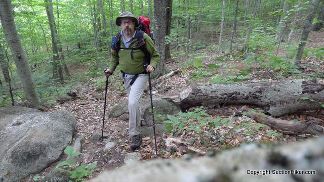
Feeling the need for a little “extra” adventure, I recently took a two-day backpacking trip to this area to hike some White Mountain trails I’ve never hiked before and climb a few mountains I’d never climbed. I’m not exactly hiking all 1400+ miles of trails in the White Mountain Guidebook, but I am taking the opportunity to hike new trails when they’re on the way to New Hampshire 3000 footer list I’m working my way through. Hiking these new trails and climbing these new peaks has proven to be a wonderful diversion this year and I foresee doing the same next year.
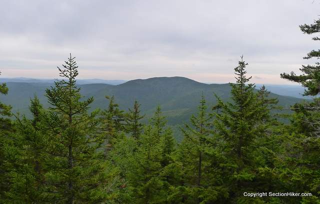
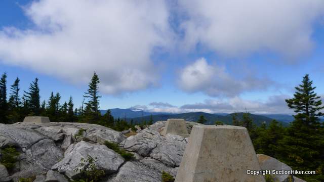
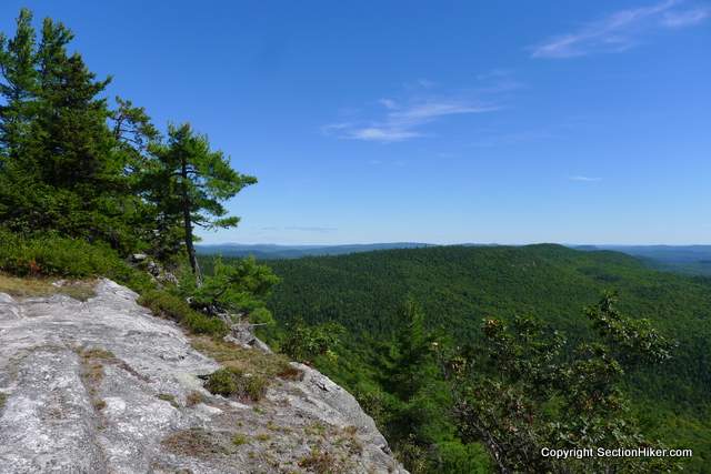
I started this loop hike at Basin Pond, a glacial basin surrounded by cliffs, and hiked along the Basin Rim Trail on the eastern edge of the Wild River Wilderness to West and East Royce Mountains. West Royce (3210′) is on the NH3000 list, but East Royce (3114′) has nicer views. After East Royce, I climbed back down to Evans Notch before entering the Caribou-Speckled Mountain Wilderness en route to Speckled Mountain (2906′), which has stunning views of the Maine wilderness to the northeast and the Carter-Wildcat Range to the west. I could even see Mt Washington’s summit clearly in the distance. Both West Royce and Speckled Mountain are former fire tower sites and the tower foundations are still evident.
From Speckled Mountain, my route followed the Blueberry Ridge Trail, which is one of the nicest trails I’ve ever hiked in the Whites (ledge/open views) to Blueberry Mountain (1781′), before descending back to Brickett Place and walking one mile back to my car at Basin Pond. The total distance of this hike is 15 miles with 5,000 feet of elevation gain, which I spread over two days and one night, with plenty of stops for view gaping.
While the mountains on this route might seem “low” in comparison to their 4000-6000 foot counterparts in the western parts of the White Mountain National Forest, I’d rate this hike as strenuous and challenging because there are long stretches where you need to carry extra water (particularly in autumn when streams are dry) and because the elevation gains from the floor of Evans Notch to the surrounding ridges and peaks are still significant.
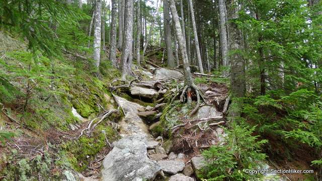
For example, the elevation of Basin Pond is 675′ which is about 1000′ lower than the majority of trailheads in Pinkham Notch, so you’re starting from a much lower elevation, to begin with. The trails are full of roots and rocks, like the rest of the White Mountains region, but the mountains are much more exposed with numerous open ledges, that require some care in climbing or descending, and should probably be avoided altogether if it’s raining.

Leaving from Basin Pond, (where swimming is not recommended due to a leech problem), I climbed the Basin Pond Trail. Basin Pond is adjacent to two forest service campgrounds Cold River and the Basin Campground. There’s a big parking lot adjacent to the pond which is where I parked my car for this trip (a White Mountain parking pass is required).

Basin Pond is a beautiful location, surrounded on three sides by high cliffs. The pond itself is artificial, at least at its current levels, with an earthen dam at one end to control flooding on the Cold River.
The Basin Trail starts next to the pond running through open woods before it starts to climb steeply to the Basin Rim Trail above. There’s a side loop along the way to Hermit Falls which I followed, which was pretty but running a bit low at this time of year. I filled up a reservoir here in order to carry extra water because there are so few water sources between this point and the base of East Royce Mountain. This turned out to be very prudent because most of the streams I passed for the remainder of the day had run dry.

I climbed to the ridge and paused near Rim Junction to take in the view of Basin Pond far below. The weather had turned colder so I put on a light raincoat to cut the chill. The Black Angel, Basin, and Basin Rim trails all meet at Rim Junction, which is located near the site of the Blue Brook tent site. I backpacked through here last fall with my friends Guthook and Steve on another epic route through the Wild River Wilderness and the Baldfaces, which I also recommend.
Hiking along this section of the Basin Rim Trail is pleasant but there are more ups and downs along the route than you might expect and add up over time. Most of the views are partially occluded by trees, although you can catch glimpses of Ragged Jacked and Mt Meader. The West Royce summit is not marked (there is a trail sign there, but it makes no mention of the peak), nor is the short spur trail to the old fire tower fittings which you can see through the trees. I stopped there for a spell to eat a snack, but the trees have apparently grown in since the fire tower was removed and there are no views.

The summit of East Royce is much more satisfying with an open summit, reached after a steep ledge scramble. Once there, you can admire the cliffs and ledges of West Royce properly, along with more views of the Carter-Wildcat Range and Speckled Mountain, on the other side of Evans Notch. I met the first and only person I was to see on the first day of my trip at the summit, a “novice” backpacker who’d just spent 10 days backpacking through the area with her black lab, Jessie.
She was openly carrying a big black semi-automatic pistol for self-protection, the first I’ve ever seen anyone wearing on a hiking trail in New England. She had a huge backpack and had just carried 2 gallons of water to the summit so she could camp on it that night with her dog. I explained to her that the black triangle on her map meant that East Royce was a mountain top and not a campsite, and suggested that she camp closer to where her ride was going to pick her up the next day. I knew that a front was going to blow through later that afternoon and the summit would be a pretty inhospitable place to camp.
The day was waning, so I left her and climbed down East Royce via the steep East Royce Trail, pausing again to load up on more water since I knew it would be scarce when I entered the Caribou-Speckled Mountain Wilderness. The streams were really surprisingly low for this time of year, and after going thirsty on my last backpacking trip one night (Backpacking West Moat Mountain). I was happy to carry a little extra water. I ended up needing it the next day…when I couldn’t find a spring on Speckled Mountain.

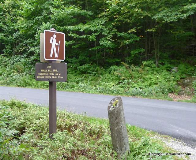
The East Royce Trail leads down to Rt 113, a seasonal road (closed in winter) that runs through the middle of Evans Notch. There’s some sort of poorly marked detour at the end of the trail before the road that I couldn’t figure out, so I continued down the “old” trail which has some blowdowns on it and found the trailhead. The Spruce Trail starts immediately on the other side of Rt 113, so I started climbing it out of the Notch.
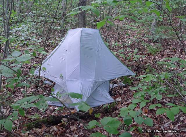
It was about 4:30 pm and I started to hear the sound of leaves falling around me in the forest. There’s still not much autumn color out, so I found the sound to be a little curious until I realized that it wasn’t leaves, but rain. The good news is that I had planned to stealth camp off the Spruce Trail before crossing the Caribou-Speckled Mountain Wilderness boundary, so I was had arrived at the area where I wanted to camp for the night. The bad news was that I had a double-walled tent with me, an REI Dash 2, and I worried that I’d have to pitch it in rain and that the inner tent would get wet in the process.
The first order of business was to find a good tent site. I’d already passed the boundary of the Forest Protection Area, the quarter-mile no camping zone that surrounds trailheads, shelters, scenic areas, and trail junctions, so I headed off-trail and into the woods to find an open, level pitch without a lot of vegetation growing in it. This took a bit longer than I would have liked, but I eventually found a decent enough spot and proceeded to pitch the tent.
The rain has started to fall more heavily by now, but I was still protected from its full fury by the surrounding forest. I managed to pitch the tent very quickly and avoid getting the inner tent wet, but it was a close thing. I got inside just at the wind picked up and the rain started to fall in sheets. I was tired and a little chilled so I got into my sleeping bag and ate a cold meal, cheese, and tortillas, before heating up a quick cup of soup outside in the rain in my Jetboil. After I drank that up, I hung my Ursack (bear bag) and read for a while before falling asleep for the night.
After breakfast the next morning, I made my way back to the Spruce Trail, headed once again toward Speckled Mountain. This is a beautiful trail, that gets even prettier once you cross into the Caribou-Speckled Mountain Wilderness. The smallest of the six designated Wilderness Areas in the White Mountain National Forest, the Caribou-Speckled Mountain Wilderness is also the newest, formed only in 1990 with just over 11,000 acres of protected land.
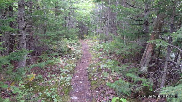
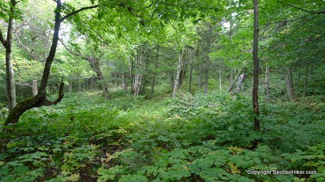
This section of Spruce Trail runs through open forest, over trails that are clearly old lumber roads. Still, it has a remote feel to it and there is little evidence that many people hike here. I was actually more worried about running into moose this time of year than anything since it’s getting close to the autumn rut and an ill-tempered bull moose can be very dangerous. Since I was hiking alone on this trip, I made a point of calling out periodically, especially when I was walking near high brush or through open meadows.

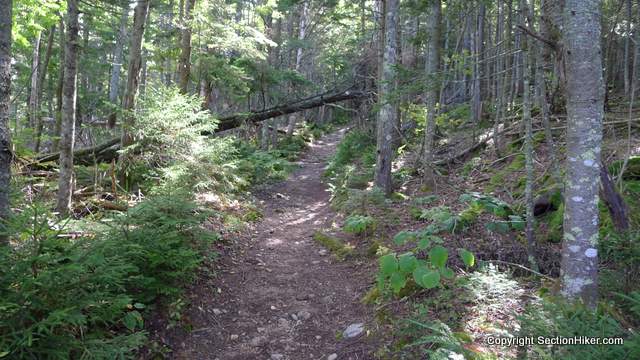
After crossing the wilderness boundary, the Spruce Trail begins to climb, switchbacking through hardwood forest. Hikers follow the Spruce Trail and the Bickford Brook Trail to the open ledges of Speckled Mountain, passing through primitive forest and open meadows before reaching the summit area.

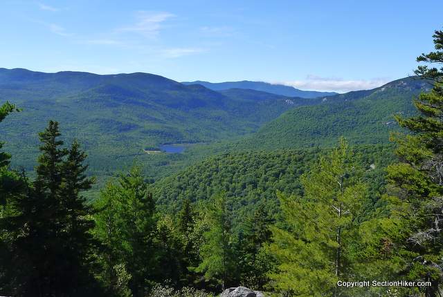
I was the first visitor to arrive at Speckled Mountain that morning. It was a beautiful bright autumn day but the wind was blowing cold and fierce. I found a warm spot on the rocks out of the wind and settled in to admire the view. I could see the cliffs on West and East Royce Mountains across the Notch where I’d stood the previous day and as far as the weather towers on Mt Washington some 40 miles away. I live for days like this in the mountains, where you can feel the bright sun on your face and breathe in crisp clean air.
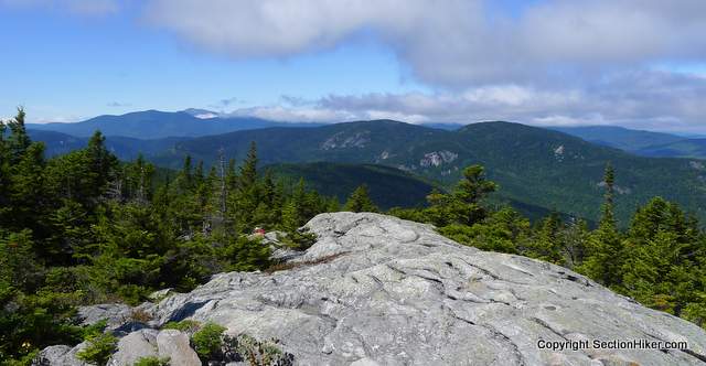
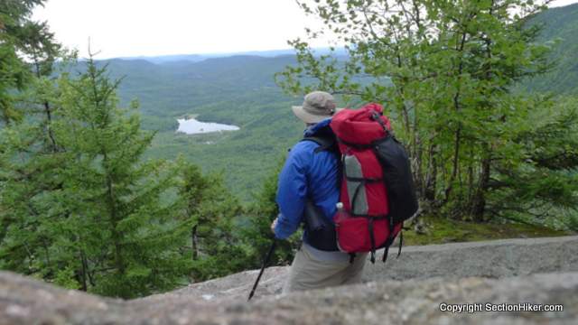
I backtracked a bit from Speckled Mountain to the Blueberry Ridge Trail Junction and headed south, deeper into Evans Notch. The Blueberry Ridge Trail runs for 2.2 miles to Blueberry Mountain over open ledge with numerous views of the ponds and peaklets in Maine, the cliffs of Evans Notch and the bald summits of North and South Baldface Mountains. Marked with cairns, the trail is relatively easy to follow and provides many scenic viewpoints along its length.


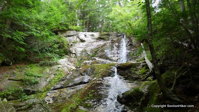
From Blueberry Mountain, the trail descends steeply to Brickett Place, a historic home managed by the Forest Service off Rt 113 in Evans Notch. Before I got there, I passed the junction with the Bickford Brook Trail and the Bickford Slides, which is a day hiking loop past a beautiful series of waterfalls – something I’ll need to return to hike.

From Brickett Place, it was a short road walk through Evans Notch back to my car at Basin Pond and the end of a wonderful hike.
Recommended Guidebooks and Maps:
- Appalachian Mountain Club White Mountain Guide, 31st ed.
- AMC White Mountain National Forest Map Set
- White Mountains Map: New Hampshire and Maine
Great report. We hike there several times a month and each time is more enjoyable than the last.
It’s obviously a well kept secret. I’m surprised more east coast hikers aren’t interested in this region. It’s a gem and worth the extra 30 minutes to get there.
The whole area surrounding Evans Notch is pretty special, Basin Rim and Blueberry Ridge being two of my favorite trails in the Whites. Doing the NH 3k’s is as good an excuse as any to redline!
Bill – you are really ripping up the redline list buddy! I should probably add up my mileage list, although I’m too busy hiking. :-)
I’m loving it! Can’t get enough of the new trails, though their numbers diminish weekly. Just about to leave for another backpack, and here I was almost done writing up the last one! :-)
I am binging myself. My wife complained that I was out every weekend for 8 weeks. Backpacking in the Whites is a great way to do a lot of redline miles. Day hikes are good too, but there’s nothing like seeing 30-40 miles of new trail at a time. Enjoy yourself!
Philip I recommend the Royce Trail also in this area. The falls are beautiful and worthy of exploration as well. The last quarter mile is steep and rocky (even by White Mtn standards) but worth the effort.
Looks like a great place to hike, those views are amazing