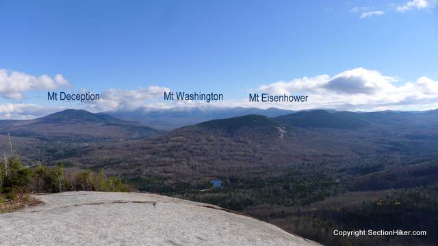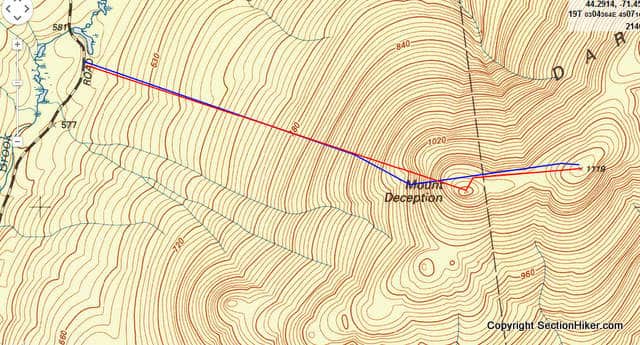
I’ve fallen in with a delightful group of bushwhackers who enjoy hiking up trailless peaks as much as I do. Our latest conquest were the twin summits of West and East Deception (3671′), two 3000 footers that overlook the valley with the Cog railroad station at the foot of Mt Washington. West and East Deception (also named Mt Deception) are two of the more prominent peaks on the Dartmouth Range, which starts to the east at Jefferson Notch and runs west to Rt 302. While the Dartmouth Range is currently trailless, the Deception Trail used to run the length of the range from the western end of Cherry Mountain Road, over Pine Mountain, site of a former fire tower, to the Israel River Ranger Station in Jefferson Notch.

This bushwhack was relatively straightforward as bushwhacks go through open forest for most of the route. We started at Campsite 7 off Cherry Mountain Road, where I’d camped the night before, crossing the brook behind the campsite and heading uphill. Our primary objective was East Desolation which is on the New Hampshire 3000 footer list, but we decided to climb West Deception en route.

The woods below 3000 feet were open and the leaves were down so we had good visibility ahead. The ground was muddy in spots, but it could have been a lot worse. We’d postponed this hike one week due to heavy rain the prior week, a good call considering the amount of water we encountered.
The weather was cool with cold mist at higher elevations, but we warmed up quickly as the we started climbing at a rate of about 1000 feet per mile. Off trail hiking is so much harder than on-trail hiking, even in the White Mountains (which are notoriously steep and rough) because there is no trail. You need to put your trust in a compass bearing and slowly pick your way through a veritable minefield of rotting biomass, blown over trees, and ledges, crawling or pulling yourself uphill by grabbing onto roots or adjacent trees to gain elevation. I’m sore all over after off-trail hikes because it’s such a full body workout.

West Deception got really steep the final 250 feet to the summit, but the way remained relatively open right up to the summit crown. The Mt Washington valley below was socked in by cloud, although we could see nearby East Deception on the other side of saddle, which was full of dense spruce. Rather than attack it head on, we dropped down about 100 feet and walked along the north side of the saddle making good time.

I found some evidence of very old paths near the summit but they were heavily obstructed by fallen trees. One did lead us to the canister, although we all walked past it at least once, only finding it when we were about to give up searching. The last group to climb the peak had been there in August 2014, and we were only the third-party to climb the peak this year, judging by the register entries.
On the descent, we retraced our steps going back the way we’d climbed up, ending the hike at Campsite 7, about 30 yards from where we’d started (which pretty much never happens). This was an easy bushwhack compared to some of the others we’ve done recently. Full-on winter conditions are just a few weeks away though and I expect to taper my bushwhacks off soon until early next spring.
 SectionHiker.com Backpacking Gear Reviews and FAQs
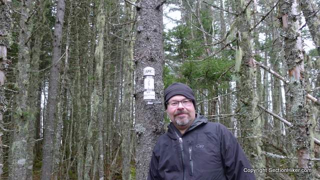
The photo is of a fine bunch of bushwhackos. Thanks for the photos.
Hahaha! I like that moniker. And with PW’s hat on my head, I’m out of central casting. Fun weekend!
A fine narrative of our noble endeavor. Long live Bushwhackos! Thanks! bunny.
Please share further bushwacking adventures come spring!!
I might still sneak a few in before then. :-)
I would love to join your group one of these days. Hopefully in the spring. And I want to attend one of your map & compass courses too. I kind of know how to do that, but I would like what I know solidified by a pro!
David – I’m very tempted to teach a class this winter, if only because compass navigation is such an important skill in winter. I’ll keep you posted.