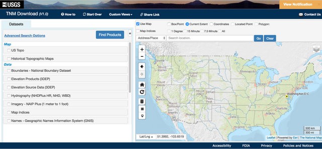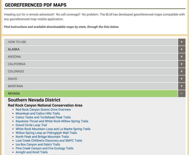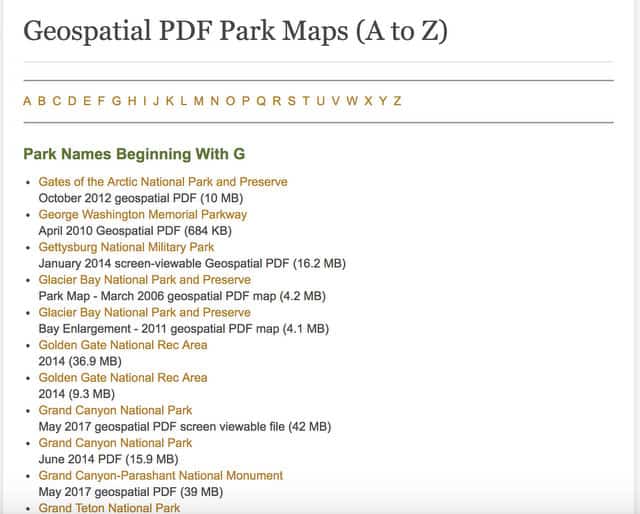
Most US Government Land Management Agencies, including the United States Geological Survey, the National Park Service, the United States Department of Agriculture, and the Bureau of Land Management publish FREE maps using a format called GeoPDF. Like Adobe PDF documents, these maps can be displayed on many different computers, tablets, and devices, including mobile phones. The ‘Geo’ part of a GeoPDF document makes the map GPS aware, so you can use it with a FREE mobile GPS app like Avenza’s PDF Maps (IOS and Android) to navigate in the backcountry. Most government agencies recommend using this app to navigate with their GeoPDF maps.
Does that mean you don’t have to pay websites and other app publishers for GPS-enabled maps for your phone? That’s exactly what it means. All of the mapping data collected and distributed by US government agencies is freely available to the public. Websites and app makers who charge you for these maps are simply repackaging and selling it to you for a profit. If you want to save some money, you can download these maps for free and use the free version of Avenza PDF Maps to navigate with them, including:
- Finding your current location using the GPS receiver in your mobile phone
- Adding waypoints to a map
- Recording GPS Tracks, so you can backtrack at the end of a hike
- Find locations by their GPS coordinates
- Display geotagged photos on a map, referenced by their GPS information
It also means that independent map publishers and hiking guidebook authors can publish their own GeoPDF maps, that readers can use to navigate with the Free Avena PDF Maps app. For example, in my FREE Guidebook: Backpacking the White Mountain 4000 Footers, I include a free GeoPDF map with every trip plan. Here are a few examples:
Free US Government GeoPDF Map Sources
Here’s a partial list of the free GeoPDF maps that you can download from US Government agencies. There’s some great information here for hiking and backpacking, as well as bikepacking, if you like to explore gravel roads deep in the backcountry.
United States Geological Survey (USGS): The USGS publishes Topo GeoPDF maps for every quadrangle in the United States, including the current National Map and Historic Map series, dating back into the 1800’s. There are hundreds of other GeoPDF maps on the USGS website, that I’d encourage you to explore.

Bureau of Land Management (BLM): The BLM publishes a large number of GeoPDF maps for the areas they manage. These are particularly good for finding backcountry roads, trails, and trailheads in National Monuments, Forest Reserves, Recreation Management Areas, and National Conservations areas managed by the BLM. Most of these lands are west of the Mississippi River.

The US Forest Service (USFS): The US Forest Service also publishes a large assortment of GeoPDF maps. The most relevant ones for hikers and backcountry use are FSTopo and Motor Vehicle Maps, which include roads authorized for OHV (Off-Highway-Vehicle) use in areas managed by the USFS. FSTopo augments the quadrangles published by the USGS with hiking trail and National Forest specific information and is usually more up-to-date than the USGS quads for the same areas (Starting in the mid-90’s the USGS halted field-checking of backcountry structures and trails for budget reasons, delegating that function to sister agencies like the USFS and NPS, who are responsible for managing those land resources and parcels.)

The US National Park Service (NPS): The NPS also publishes a series of GeoPDF maps for the lands that it manages. These range in detail from overview maps to detailed property maps and can be a valuable resource for visitors.

Using Avenza’s PDF Maps App
Here’s a quick walk-though of how to use the Free Version Avenza PDF Map App for navigating with GeoPDF maps. Try downloading some of the free GeoPDF maps referenced above and to see how you can use them to navigate with a smartphone on hikes, backpacking trips, and in the backcountry.
SectionHiker is reader-supported. We only make money if you purchase a product through our affiliate links. Help us continue to test and write unsponsored and independent gear reviews, beginner FAQs, and free hiking guides. SectionHiker.com Backpacking Gear Reviews and FAQs
Great summary and resource summay – thanks!
Phil,
Over the last few years you have published multiple articles of how to navigate electronically. I have come from a map and compass background. I guess I’m technology disabled, but want to learn how to use my phone for all of these great resources. What would you recommend to begin with in being able to navigate electronically? I need to move in baby steps. So where do I begin? My area does not offer any classes regarding this. Any information is welcome and appreciated. Than you for all you do!!!
Download the apps and just experiment with them. The biggest hurdle is getting comfortable in using your phone, not the navigation itself. Start pressing buttons. You won’t break anything. I just taught an app class and that was my big lessons learned takeaway. And keep that compass handy. Those skills are foundational. We teach how to use a compass in our app 101 classes.
I will give it a whirl. I’m assuming you meant the apps in this article, correct. I have seen many articles on your site regarding navigation with apps. I just want to make certain of the correct one.
Thanks for the awesome info.
Weird. The ones on the images work – fixed all of them. thanks for the heads up
I’m surprised I haven’t heard of this one before. Thanks!
Is there a way to convert these maps for use on a Garmin GPS?
nope.
I have used Cal-Topo to plan my hike, then download it as pdf. Cal-Topo pdf map includes gps info.
I bring my map into Avenza and hike along the trail on a map on my cellphone. I have found it works nicely.
Thanks.
Yup. Most of my maps are GeoPDF generated by Caltopo.