Navigation and Trip Planning
-

Winter Navigation and Escape Route Planning
Whenever you plan hikes in exposed terrain, it’s useful to plan out escape routes in case an unexpected thunderstorm storm…
Read More » -

How to Increase Your Daily Hiking Mileage
There will probably come a time in your hiking career where you need or want to do a big day…
Read More » -

What is Book Time?
There’s an expression used in many hiking guides called book time. Also known as Naismith’s rule, it refers to the…
Read More » -


53 Bushwhacking Tips for Off-Trail Navigation
Bushwhacking is a form of off-trail navigation through forested areas, so-called because the trees and ground vegetation whack back when…
Read More » -


Wilderness Navigation and Route Planning
Wilderness navigation requires planning routes across terrain that doesn’t have pre-defined trails or roads to follow. While following a route using…
Read More » -

Why are Topographic Maps Important for Hiking and Backpacking?
Topographic maps are used by hikers and backpackers to plan routes, estimate travel times, find water, good campsites, and track…
Read More » -


How to Navigate with GeoPDF Maps
Most US Government Land Management Agencies, including the United States Geological Survey, the National Park Service, the United States Department…
Read More » -
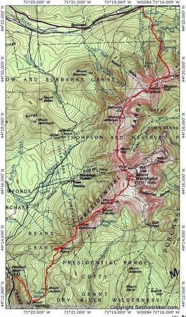

Time Control Plan for a Presidential Traverse
How long does it take to hike a Presidential Traverse? That depends on a lot of factors, but there is…
Read More » -


Hiking Above Treeline
Above Treeline. If those words don’t scare you or at least raise your guard, then you should read this post…
Read More » -


Slope Angle Shading in GaiaGPS and Caltopo
One of the hallmarks of good hiking and backpacking navigation is picking trails or routes that reduce the level of…
Read More » -
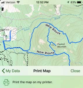

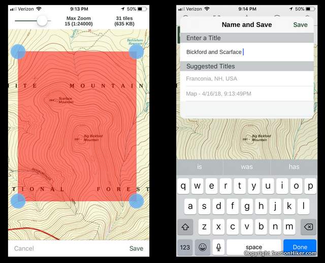
How to Print Paper Maps Directly from the Topo Maps+ Mobile GPS Navigation App
I’ve been evaluating a mobile navigation app for the past few months called Topo Maps+ (IOS only) that lets you print…
Read More » -


Backpacking in a Hurricane
I backpacked the northermost section of Vermont’s Long Trail during Hurricane Ike in 2008. I didn’t realize that I was…
Read More » -


GaiaGPS App Setup and Battery Management Tips
GaiaGPS is the smartphone navigation app that I teach students how to use, in addition to map and compass, in…
Read More » -

How to Use the Gaia GPS Smartphone App in Offline Mode
I’m often asked whether Smartphone GPS Navigation Apps like Gaia GPS can work when they’re not connected to a cell phone…
Read More »


