
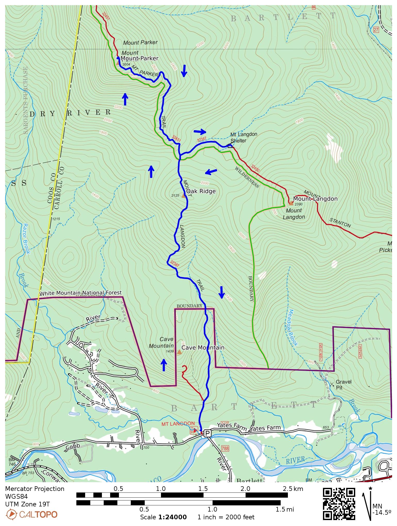
Mt Parker is a 3004 ft mountain in the Presidential-Dry River Wilderness with expansive views of Mt Washington and the Southern Presidential Range. It’s also on the 52-With-a-View Peakbagging List, which many New Hampshire hikers gravitate to after they’ve completed a round of the White Mountain 4000 footers and want to explore more of the White Mountain National Forest. While many people day hike the 8 miles to Parker and back, it also sets up a pleasant one-night backpacking trip to the Mt Langdon Campsite (former site of a lean-to since removed), just a half-mile off the Mt Parker route. Wild and remote, the Mt Langdon Campsite also provides a good place for beginner backpackers to practice campsite selection, hanging a bear bag, and filtering stream water before undertaking trips into the more remote Wilderness Areas of New Hampshire and Maines’ backcountry areas.
Rating/Difficulty
**/2 out of 5
Distance/Elevation Gain
8.6 miles w/3000′ of cumulative elevation gain
Recommended Duration
1 night
Season
July thru October
Permits Required
None.
Regulations
Backcountry Camping Regulations for the White Mountain National Forest.
Most of this route passes through the Presidential-Dry River Wilderness Area. Please observe all wilderness area restrictions.
Trailhead Directions
Mt Langdon Trail Head (GPS: 44.097062, -71.285705). Parking is available for three cars at the trailhead with overflow parking across the street next to the Saco River Bridge.
Trail Sequence
The route follows the following trails in sequence. Refer to the AMC Crawford Notch Map which is the best waterproof map available for this region. More detailed trail descriptions can be found in the AMC White Mountain Guide (2022 ed), which is considered the hiking bible for the region. Take photos of the pages using your phone for easy reference, instead of carrying the entire book with you on hikes.
- Mt Langdon Trail 2.5 miles
- Mt Parker Trail – 1.4 miles
- Mt Parker Trail – 1.4 miles (back)
- Mt Langdon Trail – 0.4 miles
- Mt Langdon Trail – 0.4 miles (back)
- Mt Langdon Trail – 2.5 miles (back)
Scenic Highlights
The following list provides cumulate distances on the route to each view or landmark
- Presidential-Dry River Wilderness Boundary – 1.0 miles
- Oak Ridge – 2.2 miles
- Mt Parker Viewpoint – 3.9 miles
- Mt Langdon Campsite and Lean-to – 5.7 miles
Camping
Mt Langdon Campsite (free) w/ an outhouse. This was the site of an old lean too which was removed in 2023. The campsite does not have well-defined tent pads or platforms and is pretty wild, but makes a good place to practice setting up a tent in an unprepared site.
Water
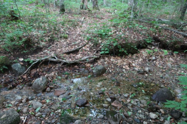
There is only one water source between the Mt Langdon Trailhead and Mt Parker and that is a small stream 1.0 mile up the trail at the 1st Presidential-Dry River Wilderness sign you’ll encounter. While the hike out to Mt Parker and back to the campsite is only 3.9 miles, you don’t want to underestimate the elevation gain which is 2550′. While the climb to Mt Parker is gradual, it is nearly continuous and I’d recommend carrying 2 or even 3 liters to get you back to the brook at the campsite in good spirits. Filtering or purifying the water in that brook is highly recommended. If the campsite brook is running dry or very low, follow it in a northeasterly direction and you should find more water within a quarter of a mile.
If you hike in the White Mountains, I also recommend purchasing the FarOut White Mountain National Forest Smartphone App (IOS, Android) which is a GPS guide to the major trails, trailheads, shelters, campsites, views, and water sources in the White Mountains National Forest. I use it all the time and it is much more accurate than using the maps bundled with the Gaia Smartphone App.
On the Trail
Mt Langdon Trail
Pass between the boulders marking the beginning of the Mt Langdon Trail next to the trailhead parking lot. There is a fenced-off gravesite belonging to Dr. Leonard M. Eudy (1843-1877) on your immediate right just to the right of the boulders which is worth a brief visit. Dr. Eudy served in a regiment of New Hampshire Volunteers during the Civil War and later went to medical school at Harvard. When he lived in Barlett, smallpox broke out in one of the lumber camps and he took charge to fight the epidemic. He contracted the disease himself and did not survive. The grave marker says “He gave his life for the people of Bartlett”. More info here: https://www.bartletthistory.org/bartletthi…/cemeteries.html
Return to the trail and continue away from the trailhead lot following an old dirt road which gradually narrows as it climbs uphill, passing the Cave Mountain Trail on your left after 0.3 miles. The trail is not blazed but it is easy to follow if you keep going straight and follow the beaten path, bypassing the side trails and logging cuts that fork off the trail for the first mile until you reach the Presidential-Dry River Wilderness sign. Many of the hiking trails in the White Mountain National Forest are lightly blazed, particularly in Wilderness Areas, so view this as a practice session for future use. If you see large red blotches pained on trees in this area, they are not blazes but private property boundary markers, another common practice in the region.
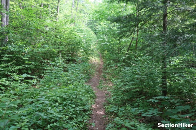
After 1 mile, you pass the Wilderness Boundary sign and cross a small stream. The trail continues to be unblazed but is even more obvious than before to follow. There are several very small stream crossings after this point before you begin the ascent up Oak Ridge, passing through open forest.

When you reach the top of Oak Ridge you’ll descend several hundred feet to the Oak Ridge-Mt Parker Col, passing another Wilderness Area sign on your left at the bottom of the hill. The descent from the top of Oak Ridge to the col passes through a very pleasant corridor of Oak and Beech trees, that feel like they’ve been planted to mark the sides of the trail.
At 2.5 miles you’ll come to the junction of the Mt Parker Trail and the Mt Langdon Trail. You’ll continue straight at this point headed toward Mt Parker. You’ll return to the junction after summiting Mt Parker to hike to the Mt Langdon Campsite which is only 0.4 miles away, to the east.
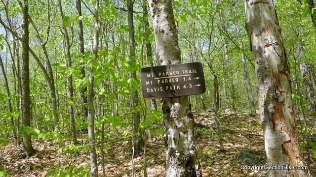
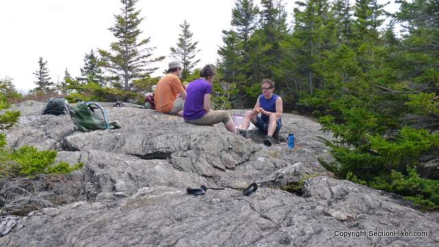
After leaving the junction, the Mt Parker trail climbs, at times relentlessly, to the rocky summit of Mt Parker, where you’re treated to marvelous views of Mt Washington and lesser peaks on the horizon. The total elevation gain required to climb Mt Parker (from the Langdon Tr Trailhead) is 2550′, which exceeds the amount of climbing required to summit many of the White Mountain 4,000 footers. Save some of your lunch and water to hang out here and soak in the views. The next segment of the trip is mostly downhill and will proceed much more quickly.
Retrace your steps (south) back to the Mt Parker – Mt Langton Trail junction you passed through before and make a left onto the Mt Langdon Trail towards the campsite. You’ll be heading to the southeast on your compass. This trail is also unblazed and can be a bit difficult to follow very early in the season before hikers have trampled the leaf litter covering the trail from the previous Autumn, or after mid-October, after the leaves have fallen. The trail to the campsite is only 0.4 miles long and passes the campsite outhouse.
The campsite is also the site of the Mt Langdon – Mt Stanton Trail Junction. If you continue on the Mt Stanton Trail for about 100 yards you come to a shallow brook which is the campsite water source. If you decide to sleep at the campsite, there is a firepit in front and large rocks where you can sit. If you brought a tent or shelter of your own, there are plenty of pre-existing campsites and trees surrounding the campsite where you can set up a tent, tarp, or hammock. This campsite is lightly used, despite its proximity to a 52-with-a-view peak. I’ve camped here several times and never seen another person.
The next morning, retrace your steps (west) back to the Langdon/Parker trail Junction and turn left to hike back up Oak Ridge. This time it will be much easier since you only have to gain 350′ of elevation. From there, it’s downhill all the way back to the Mt Langdon Trailhead.
Updated June 2023.
About the author
Safety Disclaimer
This trip plan can not alert you to every hazard, anticipate your experience, or limitations. Therefore, the descriptions of roads, trails, routes, shelters, tent sites, and natural features in this trip plan are not representations that a particular place or excursion will be safe for you or members of your party. When you follow any of the routes described on SectionHiker.com, you assume responsibility for your own safety. Under normal conditions, such excursions require the usual attention to traffic, road and trail conditions, weather, terrain, the capabilities of your party, and other factors. Always check for current conditions, obey posted signs, and Backcountry Camping and Wilderness Area Regulations. Hike Safe and follow the Hiker responsibility code.Click for More Free 4000 Footer Backpacking Trip Plans
- Presidential Traverse
- Pemigewasset Loop
- Bonds Traverse
- Twins/Bonds Traverse
- Kilkenny Traverse
- Carter Wildcat Traverse
- Southern Presidentials Loop
- Moriah Loop
- Kate Sleeper Loop
- Howker Ridge Loop
- Isolation Loop
- Mad River Notch Loop
- Thirteen Falls Loop
- The Desolation Loop
- Willey Range Loop
- Firewardens Loop
- Carter Moriah Loop
- Cannonball Loop
- Tunnel Brook Loop
- Carter Dome Wild River Loop
- Mt Carrigan and Mt Nancy
 SectionHiker.com Backpacking Gear Reviews and FAQs
I loved Mt. Parker, one of my favorite, in fact the view from the summit is the cover photo on my FB page. I did experience the issue with following the trail, mainly shortly after the Mt. Langdon trail junction. It was late Fall, all the leaves were on the ground. It seemed you knew the direction you were suppose to go, you just couldn’t tell the exact path to follow.
I’ve had to bushwhack there in the off-season because the trail is buried in snow. It’s a short enough distance and there are good backstops (stream, trail) that you can do it without a compass, but one surely can help, magnetic or on a phone/gps.
” Many of the hiking trails in the White Mountain National Forest are lightly blazed, particularly in Wilderness Areas, so view this as a practice session for future use.” Love it! Sums up hiking in the Whites so well.
Keep it that way please!
Bit far for me to travel to from the UK, but just looking at a map, seeing the photos and reading about it takes you there and you could almost be physically walking it as you read.
Glad that comes through. Thanks.
Hey, I resemble that remark!
RIP Langdon Shelter! You will be missed!
Why was the shelter removed? Was it in poor condition?